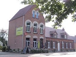
Grobbendonk | |
|---|---|
 | |
| Coordinates: 51°12′N 04°43′E / 51.200°N 4.717°E | |
| Country | |
| Community | Flemish Community |
| Region | Flemish Region |
| Province | Antwerp |
| Arrondissement | Turnhout |
| Government | |
| • Mayor | Marianne Verhaert (GiB) |
| • Governing party/ies | Gib (local Open VLD), N-VA |
| Area | |
• Total | 28.37 km2 (10.95 sq mi) |
| Population (2020-01-01)[1] | |
• Total | 11,172 |
| • Density | 390/km2 (1,000/sq mi) |
| Postal codes | 2280, 2288 |
| NIS code | 13010 |
| Area codes | 014, 03 |
| Website | www.grobbendonk.be |
Grobbendonk (Dutch pronunciation: [ˈɣrɔbə(n)dɔŋk]) is a municipality located in the Belgian province of Antwerp (Dutch: Antwerpen). The municipality comprises the towns of Bouwel and Grobbendonk proper. In 2021, Grobbendonk had a total population of 11,249. The total area is 28.36 km2.[2]
The official flag of Grobbendonk was adopted in 1989. In terms of heraldry, the flag is quartered, I and IV argent, three hills vert, a bird sable (specifically a raven), II and III gules three fleur-de-lis argent.
- ^ "Bevolking per gemeente op 1 januari 2020". Statbel.
- ^ "Bevolking per statistische sector - Sector 13010". Statistics Belgium. Retrieved 10 May 2022.


