Native name: Ayangkidarrba | |
|---|---|
 Groote Eylandt from space, November 1989 | |
| Etymology | From the Dutch for "Large Island home to Zarah" |
| Geography | |
| Location | Gulf of Carpentaria |
| Coordinates | 13°58′S 136°35′E / 13.967°S 136.583°E |
| Area | 2,326.1 km2 (898.1 sq mi) |
| Length | 50 km (31 mi) |
| Width | 60 km (37 mi) |
| Highest elevation | 219 m (719 ft) |
| Highest point | Central Hill |
| Administration | |
Australia | |
| Territory | Northern Territory |
| Region | East Arnhem Region/ unincorporated Alyangula |
| Ward | Anindilyakwa Ward/ unincorporated Alyangula |
| Largest settlement | Alyangula (pop. 966) |
| Demographics | |
| Population | 2,811[1] (2016 census) |
| Pop. density | 1.21/km2 (3.13/sq mi) |
| Ethnic groups | Warnindhilyagwa, European Australians |
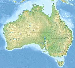
Groote Eylandt (Anindilyakwa: Ayangkidarrba; meaning "island" /ˈɡruːtˌaɪlənd/[2]) is the largest island in the Gulf of Carpentaria and the fourth largest island in Australia. It was named by the explorer Abel Tasman in 1644 and is Dutch for "Large Island" in archaic spelling. The modern Dutch spelling is Groot Eiland.
The original inhabitants of Groote Eylandt are the Anindilyakwa, an Aboriginal Australian people, who speak the Anindilyakwa language (also known as Amamalya Ayakwa). They consist of 14 clan groups which make up the two moieties on the island. The clans maintain their traditions and have strong ties with the people in the community of Numbulwar and on Bickerton Island. The island's population was 2,811 in the 2016 census.
There are four communities on Groote Eylandt. The mining company GEMCO established the township of Alyangula for its workers.[3] The three main Aboriginal communities are Angurugu and Umbakumba, and Milyakburra on Bickerton Island. There are also a number of outstations on the island.[4]
The Anindilyakwa Land Council is one of four land councils in the Northern Territory. It is a representative body with statutory authority under the Aboriginal Land Rights (Northern Territory) Act 1976 and has responsibilities under the Native Title Act 1993 and the Pastoral Land Act 1992.
- ^ "Anindilyakwa (SA2) (702041062)". stat.abs.gov.au. Australian Bureau of Statistics. Archived from the original on 31 December 2017. Retrieved 29 October 2017.
- ^ Wells, J.C. (2008). Longman Pronunciation Dictionary. Pearson Longman. ISBN 9781405881173.
- ^ "Groote Eylandt and Bickerton Island Regional Partnership Agreement: Progress Evaluation" (PDF). Department of Social Services. Commonwealth of Australia. May 2012. Retrieved 3 May 2015.
- ^ "Communities". Anindilyakwa Land Council. Retrieved 13 December 2021.

