Gugh
| |
|---|---|
 Central Gugh, seen from The Bar | |
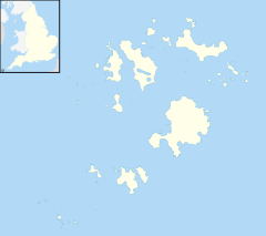
Location within Isles of Scilly | |
| Population | 3 |
| Civil parish |
|
| Unitary authority | |
| Ceremonial county | |
| Region | |
| Country | England |
| Sovereign state | United Kingdom |
| Post town | ISLES OF SCILLY |
| Postcode district | TR22 |
| Dialling code | 01720 |
| Police | Devon and Cornwall |
| Fire | Isles of Scilly |
| Ambulance | South Western |
| UK Parliament | |

Gugh (/ɡjuː/ GHEW; Cornish: Keow, lit. 'hedge banks')[1] could be described as the sixth inhabited island of the Isles of Scilly, but is usually included with St Agnes with which it is joined by a sandy tombolo known as "The Bar" when exposed at low tide. The island is only about 1 km (0.62 mi) long and about 0.5 km (0.31 mi) wide, with the highest point, Kittern Hill at 34 m (112 ft).[2] The geology consists of Hercynian granite with shallow podzolic soils on the higher ground and deeper sandy soils on the lower ground. The former Gugh farm is just north of the neck across the middle of the island between the two hills. The two houses were designed and built in the 1920s by Charles Hamlet Cooper.[3]
The island lies within the Isles of Scilly Heritage Coast, is in the Isles of Scilly Area of Outstanding Natural Beauty and is managed by the Isles of Scilly Wildlife Trust. Vegetation cover is mainly wind-pruned heath or dense bracken and bramble with a small area of coastal grassland formed over blown sand which has accumulated near the bar.
In 2013 the Isles of Scilly Seabird Recovery Project was set up by a number of organisations including the RSPB and the Isles of Scilly Wildlife Trust. The five-year project aimed to keep the islands of St Agnes and Gugh brown rat (Rattus norvegicus) free, to help breeding sea birds, which lost 25% of their populations between 1983 and 2006. A programme of habitat restoration began in January 2016 with the removal of the invasive Pittosporum (Crassifolium species).
- ^ Weatherhill, C. (2007) Cornish Place Names and Language. Ammanford: Sigma Press.
- ^ Ordnance Survey: Landranger map sheet 203 Land's End ISBN 978-0-319-23148-7.
- ^ Parslow, R. (2007) The Isles of Scilly. New Naturalist Library. London: Collins.
