| Gungahlin Australian Capital Territory | |||||||||||||||
|---|---|---|---|---|---|---|---|---|---|---|---|---|---|---|---|
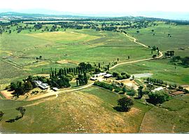
 Gold Creek was typical of the sheep properties of the Gungahlin region prior to development. | |||||||||||||||
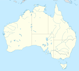
 Location of Gungahlin in the Australian Capital Territory | |||||||||||||||
 | |||||||||||||||
| Coordinates | 35°10′59″S 149°07′59″E / 35.1831°S 149.133°E | ||||||||||||||
| Population | 87,682 (2021 census)[1] | ||||||||||||||
| • Density | 967.8/km2 (2,506.6/sq mi) | ||||||||||||||
| Gazetted | 12 May 1966[2] | ||||||||||||||
| Area | 90.6 km2 (35.0 sq mi) | ||||||||||||||
| Location | 10 km (6 mi) N of Canberra | ||||||||||||||
| Territory electorate(s) | Yerrabi | ||||||||||||||
| Federal division(s) | Fenner | ||||||||||||||
| |||||||||||||||
Gungahlin (/ˈɡʌŋɡɑːlɪn/) is a district in the Australian Capital Territory, one of the fastest growing regions in Australia. The district is subdivided into suburbs, sections and blocks. Gungahlin is an Aboriginal word meaning either "white man's house" or "little rocky hill".[3]
As of 2022[update] Gungahlin comprised sixteen suburbs, including several under construction and a further suburb planned. The town of Gungahlin was part of the original 1957 plan for development in the ACT and in 1991 was officially launched as the fourth 'town' by the ACT Chief Minister. At the time, the population of Gungahlin was just 389 residents. At the 2021 census, the population of the district was 87,682.[1]
Within the district is the northernmost town centre of the ACT, situated 10 kilometres (6 mi) north of Canberra City ("Civic" in the local parlance); one of five satellite cities of the ACT, with Woden, Tuggeranong, Weston Creek and Belconnen.
- ^ a b Australian Bureau of Statistics (28 June 2022). "Gungahlin (SA3)". 2021 Census QuickStats. Retrieved 12 September 2022.
- ^ "Districts Ordinance 1966 (ACT)" (PDF).
- ^ Search for street and suburb names - Environment, Planning and Sustainable Development Directorate - Planning[permanent dead link]
