| Ha! Ha! River | |
|---|---|
 | |
 | |
| Location | |
| Country | Canada |
| Province | Quebec |
| Region | Saguenay–Lac-Saint-Jean |
| Regional County Municipality | Le Fjord-du-Saguenay Regional County Municipality |
| City and protected area | Laurentides Wildlife Reserve, Ferland-et-Boilleau, Quebec, Saguenay, Quebec |
| Physical characteristics | |
| Source | Mountain and Forest streams |
| • location | Laurentides Wildlife Reserve |
| • coordinates | 47°51′19″N 70°51′07″W / 47.85528°N 70.85194°W |
| • elevation | 780 m (2,560 ft) |
| Mouth | Saguenay River (via Baie des Ha! Ha!) |
• location | Saguenay, Quebec, a city |
• coordinates | 48°19′04″N 70°51′35″W / 48.31778°N 70.85972°W |
• elevation | 4 m (13 ft) |
| Length | 80.5 km (50.0 mi) |
| Discharge | |
| • location | Saguenay, Quebec |
| Basin features | |
| Tributaries | |
| • left | (upstream from the mouth) Forcade stream, ruisseau le Savanier, outlet of lac de la Savane, Bras d'Hamel, outlet of lake Edgar, outlet of lac à Louis-Potvin, outlet of unidentified lakes, rivière à Pierre (via lake Ha! Ha!), outlet of lake Opmecho, outlet of lake Rastoulle and lake Globule, outlet of lakes Safran et Pé, outlet of lake Loups-Cerviers, outlet of lake Pilote. |
| • right | (upstream, from the mouth) Ruisseau Price, décharge du lac Bergeron, décharge du lac à Bois, rivière des Cèdres, outlet of lake Grand-Père, outlet of lake Grand-Mère, Huard River, outlet of petit lac Ha! Ha! (via lake Ha! Ha!), outlet of lake Droux, outlet of lake Arconet, outlet of lake Ménard. |
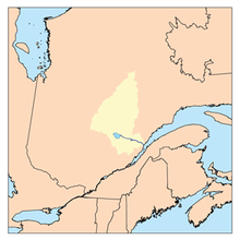
The Ha! Ha! River is a watercourse in Saguenay–Lac-Saint-Jean, Quebec, Canada.[1]
Its course is entirely located in Saguenay-Lac-Saint-Jean, in the Dubuc provincial constituency and the federal district of Chicoutimi-Le Fjord. The river is shared between the MRC of Le Fjord-du-Saguenay Regional County Municipality (through the town of Ferland-et-Boilleau, Quebec) and the city of Saguenay crossing the La Baie, Quebec borough of Saguenay.
The Ha! Ha! River was severely affected during the Saguenay Flood.
The southern part of Petit lac Ha! Ha! is served by Route 381 to the bridge that marks out the Petit lac Ha! Ha! and Lake Ha! Ha!. This bridge spans the water level at the peninsula attached to the North Shore, then the road heads northwest, serving the northwestern part of the lake Ha! Ha! and the lower part of the Ha! Ha! River Valley.
Forestry is the main economic activity of the sector; recreational tourism activities, second; agriculture is practiced around the lower segment of the river to the urban area (Grande-Baie sector).
The surface of Ha! Ha! River is usually frozen from early December to late March, however, safe ice circulation is generally from mid-December to mid-March.