| Habergham Eaves | |
|---|---|
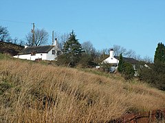
 Buildings at Higher Timber Hill Farm | |
Location within Lancashire | |
| Area | 2.87 sq mi (7.4 km2) [1] |
| Population | 1,466 (2011) [1] |
| • Density | 511/sq mi (197/km2) |
| OS grid reference | SD8319229904 |
| Civil parish |
|
| District | |
| Shire county | |
| Region | |
| Country | England |
| Sovereign state | United Kingdom |
| Post town | BURNLEY |
| Postcode district | BB11 |
| Dialling code | 01282 |
| Police | Lancashire |
| Fire | Lancashire |
| Ambulance | North West |
| UK Parliament | |
Habergham Eaves is a civil parish in the borough of Burnley, in Lancashire, England. The parish consists of a rural area south of Burnley, and suburban areas on the outskirts of the town, including a large industrial estate in the north-west corner of the parish. Habergham is also the name of an area west of Burnley, although it is no longer within the parish.[2] According to the United Kingdom Census 2011, the parish has a population of 1,466.[1]
The A646 Padiham to Todmorden road runs approximately along the northern boundary of the parish. Surrounding areas include the unparished areas of Burnley and Rossendale, and the parishes of Hapton, Dunnockshaw and Cliviger.
- ^ a b c Cite error: The named reference
Census2011was invoked but never defined (see the help page). - ^ "Map of Habergham Eaves parish". MARIO. Lancashire County Council. Retrieved 3 November 2008.

