This article needs additional citations for verification. (June 2014) |
| Hackensack River | |
|---|---|
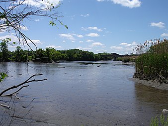
 A view of the Hackensack River taken from the shore in Teaneck at low tide | |
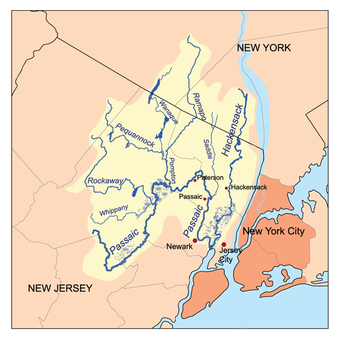
 The Passaic and Hackensack watersheds | |
| Location | |
| Country | United States |
| State | New Jersey, New York |
| Counties | Hudson, NJ, Bergen, NJ, Rockland, NY |
| City | Hackensack, NJ |
| Physical characteristics | |
| Source | |
| • location | New City, Rockland County, New York, United States |
| • coordinates | 41°11′00″N 73°59′24″W / 41.18333°N 73.99000°W |
| • elevation | 120 ft (37 m) |
| Mouth | Newark Bay |
• location | Hudson County, New Jersey, United States |
• coordinates | 40°42′55″N 74°06′42″W / 40.71528°N 74.11167°W |
• elevation | 0 ft (0 m) |
| Length | 54 mi (87 km) |
| Discharge | |
| • location | New Milford, NJ |
| • minimum | 0 cu ft/s (0 m3/s) |
| • maximum | 880 cu ft/s (25 m3/s) |
The Hackensack River is a river, approximately 45 miles (72 km) long, in the U.S. states of New York and New Jersey, emptying into Newark Bay, a back chamber of New York Harbor. The watershed of the river includes part of the suburban area outside New York City just west of the lower Hudson River, which it roughly parallels, separated from it by the New Jersey Palisades. It also flows through and drains the New Jersey Meadowlands. The lower river, which is navigable as far as the city of Hackensack,[1] is heavily industrialized and forms a commercial extension of Newark Bay.
Once believed to be among the most polluted watercourses in the United States, it staged a modest revival by the late 2000s. The river is divided into the upper river, north of the Oradell Reservoir and Oradell Dam, and lower river, south of the reservoir and dam.
- ^ "117.723 Hackensack River", Title 33: Navigation and Navigable Waters Part 117—Drawbridge Operations Regulations, US Government Printing Office, October 20, 2012, retrieved 2012-10-20