Hadiya
ሐዲያ Hossana Hosaena Hosanna | |
|---|---|
| Nicknames: Southern zones | |
| Zone | Hadiya |
| Area | |
| • Land | 527 km2 (203 sq mi) |
| Population | |
| • Total | 3,987,365 |
| [1] | |
| Time zone | UTC+3 (East Africa Time) |
| Area code | (+251) 11 |
| HDI (2018) | 0.697[2] medium · 1st |

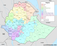
Hadiya (also transliterated Hadiyya) is a zone in the Central Ethiopia Regional State of Ethiopia. This zone is named after the Hadiya of the Hadiya Kingdom, whose homeland covers part of the administrative division. Hadiya is bordered on the south by Kembata, on the southwest by the Dawro Zone, on the west by the Omo River which separates it from Oromia Region and the Yem Special Woreda, on the north by Gurage, on the northeast by Silte, and on the east by the Alaba Zone; the woredas of Mirab Badawacho and Misraq Badawacho form an exclave separated from the rest of the zone by Kembata. The administrative center of Hadiya is Hosaena.
Hadiya has 294 kilometers of all-weather roads and 350 kilometers of dry-weather roads, for an average road density of 169 kilometers per 1000 square kilometers.[3] According to the Central Statistical Agency (CSA) 8,364.00 tons of coffee were produced in Gurage, Hadiya and KT combined in the year ending in 2005, representing 8.33% of the Southern Nations, Nationalities and Peoples' Region (SNNPR)'s output and 3.36% of Ethiopia's total output.[4]
- ^ Cite error: The named reference
Ethiopia2007Censuswas invoked but never defined (see the help page). - ^ "Sub-national HDI – Area Database – Global Data Lab". globaldatalab.org. Retrieved 14 May 2020.
- ^ "Detailed statistics on roads" Archived 2011-07-20 at the Wayback Machine, SNNPR Bureau of Finance and Economic Development website (accessed 3 September 2009)
- ^ CSA 2005 National Statistics Archived 2007-08-13 at the Wayback Machine, Table D.2