Hafslo Municipality
Hafslo herad | |
|---|---|
 View of Hafslo | |
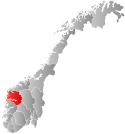
 Sogn og Fjordane within Norway | |
 Hafslo within Sogn og Fjordane | |
| Coordinates: 61°18′39″N 07°11′08″E / 61.31083°N 7.18556°E | |
| Country | Norway |
| County | Sogn og Fjordane |
| District | Sogn |
| Established | 1 Jan 1838 |
| • Created as | Formannskapsdistrikt |
| Disestablished | 1 Jan 1963 |
| • Succeeded by | Luster Municipality |
| Administrative centre | Hafslo |
| Area (upon dissolution) | |
• Total | 583 km2 (225 sq mi) |
| Population (1963) | |
• Total | 2,384 |
| • Density | 4.1/km2 (11/sq mi) |
| Demonym | Hafslobygding[1] |
| Time zone | UTC+01:00 (CET) |
| • Summer (DST) | UTC+02:00 (CEST) |
| ISO 3166 code | NO-1425[2] |
Hafslo is a former municipality in the old Sogn og Fjordane county, Norway. The 538-square-kilometre (208 sq mi)[3] municipality existed from 1838 until its dissolution in 1963. It is located in the present-day Luster Municipality (in Vestland county) in the traditional district of Sogn. The former municipality included the villages of Kinsedalen, Ornes, and Kroken on the east side of the Lustrafjorden. It also included the villages of Solvorn, Hafslo, Joranger, and the whole Veitastrond valley on the west side of the Lustrafjorden. The municipality surrounded the lakes Hafslovatnet and Veitastrondvatnet. The administrative centre of the municipality was the village of Hafslo, where Hafslo Church was located.
- ^ "Navn på steder og personer: Innbyggjarnamn" (in Norwegian). Språkrådet.
- ^ Bolstad, Erik; Thorsnæs, Geir, eds. (26 January 2023). "Kommunenummer". Store norske leksikon (in Norwegian). Kunnskapsforlaget.
- ^ Helland, Amund (1901). "Hafslo herred". Norges land og folk: Nordre Bergenhus amt (in Norwegian). Vol. XIV. Kristiania, Norway: H. Aschehoug & Company. p. 58. Retrieved 28 September 2019.