Halul Island
حالول | |
|---|---|
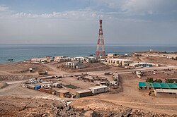
 View of northern part of Halul Island from a hill | |
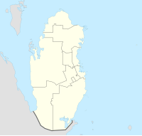
| Coordinates: 25°40′30″N 52°24′41″E / 25.67500°N 52.41139°E | |
| Country | Qatar |
| Area | |
| • Total | 1.57 km2 (0.61 sq mi) |
| • Land | 1.57 km2 (0.61 sq mi) |
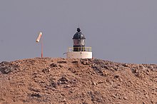
| Jazirat Halul Lighthouse | |
 | |
| Construction | concrete |
| Height | 5 m (16 ft) |
| Shape | short cylindrical tower with lantern[1][2] |
| Markings | white (tower), black (lantern) |
| Focal height | 67 m (220 ft) |
| Range | 19 nmi (35 km; 22 mi) (white), 9 nmi (17 km; 10 mi) (red) |
| Characteristic | Fl WR 12s |
Halul Island (Arabic: جَزِيرَة حَالُول, romanized: Jazīrat Ḫālūl) is one of the most important islands belonging to the State of Qatar. Lying about 90 km (56 mi) northeast of Doha, it serves as a storage area and loading terminal for oil from the surrounding offshore fields.[3] One of the main bases for the Qatari Navy is located in Halul.[4] The Coasts and Borders Security also have a base of operations on the island.[5]
It was frequented by pearling boats in the early 1900s.[6]
- ^ Rowlett, Russ. "Lighthouses of Qatar". The Lighthouse Directory. University of North Carolina at Chapel Hill. Retrieved 2016-10-13.
- ^ NGA List of Lights – Pub.112 Retrieved 13 October 2016
- ^
 This article incorporates text from this source, which is in the public domain: Toth, Anthony (1994). "Qatar: Geography". In Metz, Helen Chapin (ed.). Persian Gulf states: country studies (3rd ed.). Washington, D.C.: Federal Research Division, Library of Congress. p. 162. ISBN 0-8444-0793-3. OCLC 29548413.
- ^ RSN Singh (2008). Asian Strategic and Military Perspective. Lancer Publishers. p. 388. ISBN 978-81-7062-245-1.
- ^ Cite error: The named reference
qatarpetroleumwas invoked but never defined (see the help page). - ^ "'Persian Gulf Gazetteer Part II, Geographical and Descriptive Materials, Section II Western Side of the Gulf' [53v] (109/286)". Qatar Digital Library. 2014-04-04. Retrieved 23 July 2015.

