| Hameldon | |
|---|---|
 Hameldon viewed from Read Hall Park | |
| Highest point | |
| Elevation | 408.7 m (1,341 ft) |
| Prominence | 107 m (351 ft) |
| Parent peak | Freeholds Top |
| Listing | Hump |
| Coordinates | 53°45′23″N 2°18′49″W / 53.7563°N 2.3137°W |
| Geography | |
| Location | Lancashire, |
| Parent range | Pennines |
| OS grid | SD79412892 |
| Topo map | OS Explorer 287 |
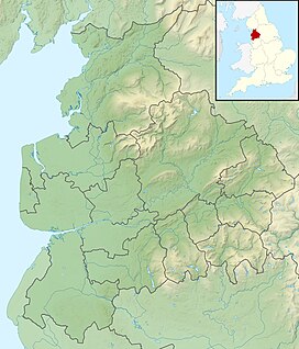
Hameldon Hill is a Carboniferous sandstone hill with a summit elevation of 409 metres (1,342 ft), situated between the towns of Burnley and Accrington in Lancashire, England. It is listed as a "HuMP" or "Hundred Metre Prominence", its parent being Freeholds Top,[a] a Marilyn near Bacup.[1]
Other nearby settlements include Hapton and hamlets of Clowbridge and Dunnockshaw in the Borough of Burnley, Huncoat and Baxenden in Hyndburn, and Crawshawbooth, Goodshaw and Loveclough in the Borough of Rossendale.
Located on the western side of the Pennines, its summit is the highest point an isolated area, separated from the South Pennines and the West Pennine Moors. The Cliviger Gorge lies to the east, the Rossendale Valley to the south, and the valley of the River Hyndburn to the west. Pendle Hill stands to the north, across the wide valley of the Lancashire Calder.
Cite error: There are <ref group=lower-alpha> tags or {{efn}} templates on this page, but the references will not show without a {{reflist|group=lower-alpha}} template or {{notelist}} template (see the help page).
- ^ Jackson, Mark (2009). "Carlisle to the Ribble and the Aire". More Relative Hills of Britain (PDF). p. 141. Archived from the original (PDF) on 13 September 2015. Retrieved 28 May 2021.
