Hamler, Ohio | |
|---|---|
 Randolph Street commercial district | |
 Location of Hamler, Ohio | |
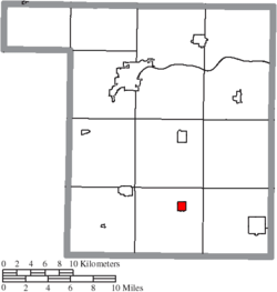
 Location of Hamler in Henry County | |
| Coordinates: 41°13′41″N 84°02′08″W / 41.22806°N 84.03556°W | |
| Country | United States |
| State | Ohio |
| County | Henry |
| Area | |
• Total | 0.83 sq mi (2.15 km2) |
| • Land | 0.83 sq mi (2.14 km2) |
| • Water | 0.01 sq mi (0.01 km2) |
| Elevation | 709 ft (216 m) |
| Population (2020) | |
• Total | 600 |
• Estimate (2023)[3] | 604 |
| • Density | 726.39/sq mi (280.56/km2) |
| Time zone | UTC-5 (Eastern (EST)) |
| • Summer (DST) | UTC-4 (EDT) |
| ZIP code | 43524 |
| Area code | 419 |
| FIPS code | 39-33096[4] |
| GNIS feature ID | 2398231[2] |
Hamler is a village in Henry County, Ohio, United States. The population was 600 at the 2020 census. Hamler is a rural farming community in Northwest Ohio about 40 miles (64 km) southwest of Toledo, Ohio. It is located at the intersection of the former Baltimore and Ohio (B&O) and former Detroit, Toledo and Ironton (D, T & I) railroads and the intersection of Ohio State Route 109 and Ohio State Route 18.
- ^ "ArcGIS REST Services Directory". United States Census Bureau. Retrieved September 20, 2022.
- ^ a b U.S. Geological Survey Geographic Names Information System: Hamler, Ohio
- ^ "Annual Estimates of the Resident Population for Incorporated Places in Ohio: April 1, 2020 to July 1, 2023". United States Census Bureau. Retrieved July 6, 2024.
- ^ "U.S. Census website". United States Census Bureau. Retrieved January 31, 2008.