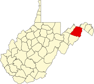
Hampshire County | |
|---|---|
 | |
 Location within the U.S. state of West Virginia | |
 West Virginia's location within the U.S. | |
| Coordinates: 39°19′N 78°37′W / 39.31°N 78.61°W | |
| Country | |
| State | |
| Founded | December 13, 1754 |
| Named for | Hampshire, England |
| Seat | Romney |
| Largest city | Romney |
| Area | |
• Total | 645 sq mi (1,670 km2) |
| • Land | 640 sq mi (1,700 km2) |
| • Water | 4.4 sq mi (11 km2) 0.7% |
| Population (2020) | |
• Total | 23,093 |
• Estimate (2021) | 23,302 |
| • Density | 36/sq mi (14/km2) |
| Time zone | UTC−5 (Eastern) |
| • Summer (DST) | UTC−4 (EDT) |
| Congressional district | 2nd |
| Website | www |
Hampshire County is a county in the U.S. state of West Virginia. As of the 2020 census, the population was 23,093.[1] Its county seat is Romney,[2] West Virginia's oldest town (1762). The county was created by the Virginia General Assembly in 1754, from parts of Frederick and Augusta Counties (Virginia) and is the state's oldest county.[3][4] The county lies in both West Virginia's Eastern Panhandle and Potomac Highlands regions.
Hampshire County is part of the Winchester, VA-WV Metropolitan Statistical Area.
- ^ "State & County QuickFacts". United States Census Bureau. Retrieved October 19, 2022.
- ^ "Find a County". National Association of Counties. Retrieved June 7, 2011.
- ^ "Hampshire County history sources". Archived from the original on May 29, 2013. Retrieved January 29, 2013.
- ^ "West Virginia: Individual County Chronologies". West Virginia Atlas of Historical County Boundaries. The Newberry Library. 2003. Archived from the original on November 20, 2015. Retrieved August 10, 2015.
