Hamre Municipality
Hamre herad | |
|---|---|
| Hammer herred (historic name) | |
 View of the Hamre coast (c. 1875) | |
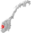
 Hordaland within Norway | |
 Hamre within Hordaland | |
| Coordinates: 60°32′47″N 05°21′30″E / 60.54639°N 5.35833°E | |
| Country | Norway |
| County | Hordaland |
| District | Nordhordland |
| Established | 1 Jan 1838 |
| • Created as | Formannskapsdistrikt |
| Disestablished | 1 Jan 1964 |
| • Succeeded by | Lindås, Osterøy, and Meland municipalities |
| Administrative centre | Hamre |
| Area (upon dissolution) | |
| • Total | 84 km2 (32 sq mi) |
| Population (1963) | |
| • Total | 2,572 |
| • Density | 31/km2 (79/sq mi) |
| Demonym | Hamarsokning[1] |
| Time zone | UTC+01:00 (CET) |
| • Summer (DST) | UTC+02:00 (CEST) |
| ISO 3166 code | NO-1254[2] |
Hamre (historically, Hammer) is a former municipality in the old Hordaland county, Norway. The municipality existed from 1838 until 1964 when it was dissolved and its lands split up among several other municipalities. It was located in what is now Alver Municipality and Osterøy Municipality in Vestland county. It was once a large municipality, but over time it was reduced in size until it covered an area of 84 square kilometres (32 sq mi) by the time it was dissolved in 1964. At that time, it encompassed land on both sides of the Osterfjorden on the Lindås peninsula on the north side and on the island of Osterøy on the south side. The administrative centre was the village of Hamre where Hamre Church was located.[3]
- ^ "Navn på steder og personer: Innbyggjarnamn" (in Norwegian). Språkrådet.
- ^ Bolstad, Erik; Thorsnæs, Geir, eds. (26 January 2023). "Kommunenummer". Store norske leksikon (in Norwegian). Kunnskapsforlaget.
- ^ Store norske leksikon. "Hamre – tidl. kommune i Hordaland" (in Norwegian). Retrieved 21 April 2014.