| Hanglip | |
|---|---|
 Hanglip from the southeast | |
| Highest point | |
| Elevation | 1,719 m (5,640 ft)[1] |
| Listing | List of mountains in South Africa |
| Coordinates | 22°59′45″S 29°53′0″E / 22.99583°S 29.88333°E |
| Geography | |
| Location | Limpopo |
| Parent range | Soutpansberg |
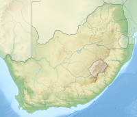
Hanglip (Afrikaans for hanging lip, Venda: Songozwi- thavha khulu ya VhaDzanani[2]) is a prominent mountain peak near Louis Trichardt, South Africa. It is situated in the Vhembe District of Limpopo in the central Soutpansberg range. The peak with radar station, at 1,719 meters a.s.l., forms a conspicuous landmark visible from the town and the N1 national road.
- ^ Explore the Hanglip Hiking Trail
- ^ Braun, Lindsay F. (2014). Colonial Survey and Native Landscapes in Rural South Africa, 1850 - 1913: The Politics of Divided Space in the Cape and Transvaal (revised ed.). BRILL. p. 254. ISBN 9789004282292.
