Hanumangarh | |
|---|---|
| Hanumangarh | |
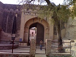
 Hanumangarh fort is located in Hanumangarh city, Rajasthan, India. | |
| Coordinates: 29°35′N 74°19′E / 29.58°N 74.32°E | |
| Country | |
| State | Rajasthan |
| District | Hanumangarh |
| Founded by | Bhupat Singh Bhati[1] |
| Named for | Hanuman |
| Government | |
| • Body | Municipal Council |
| Elevation | 177 m (581 ft) |
| Population (2011)[2] | |
| • Total | 150,958 |
| Language | |
| • Official | Hindi[3] |
| • Additional official | English[3] |
| Time zone | UTC+5:30 (IST) |
| PIN | 335512(Hanumangarh Junction)
335513(Hanumangarh Town) |
| Telephone code | 01552 |
| Vehicle registration | RJ-31 |
| Website | hanumangarh |
Hanumangarh is a city and municipal council in the Indian state of Rajasthan, situated on the banks of the river Ghaggar also identified as ancient Sarasvati river, located about 400 km from Delhi. It is the administrative headquarter of Hanumangarh District. The city was once called Bhatner (alternatively spelled Bhatnair) because it was founded by king Bhupat in 255 AD. It remained in the control of the Rajputs of Bhati clan and faced a historic siege by Timur in 1391, during which the Bhati Raput king Dulachand lost the fort for a short time.[4] The fort was later occupied by Rao Jetsa of Bikaner.[5]
- ^ शर्मा, सोनू (7 April 2020). "1700 साल पुराना भारत का वो किला, जिसपर हुए हैं सबसे ज्यादा बार आक्रमण". Amar Ujala (in Hindi). Retrieved 5 June 2024.
- ^ Cite error: The named reference
Census2011Govwas invoked but never defined (see the help page). - ^ a b "52nd Report of the Commissioner for Linguistic Minorities in India" (PDF). nclm.nic.in. Ministry of Minority Affairs. p. 8. Archived from the original (PDF) on 25 May 2017. Retrieved 20 June 2019.
- ^ Hooja, Rima (2006). A History of Rajasthan. Rupa and company. p. 371. ISBN 9788129108906.
Bhatner was taken in 1391 by Timur from the Bhati Rajput King named Dulachand
- ^ Sir William Wilson Hunter (1885), The imperial gazetteer of India, Volume 2, Trübner & Co., 1885,
... The Bhatnair fort ... on the direct route of invasion from Central Asia to India ... taken by Mahmud of Ghazni in 1001 ... attacked by Timur ... probable that Timur left a Tatar Chagitai noble in charge, who was expelled by Bhatis from Marot and Phulra ... Bhatnair, now called Hanumangarh ...


