Hardenberg
Haddenbarreg (Dutch Low Saxon) | |
|---|---|
City and municipality | |
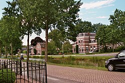
 Former headquarters of the Dedemsvaartsche Stoomtramweg-Maatschappij in Dedemsvaart | |
 Location in Overijssel | |
| Coordinates: 52°34′N 6°37′E / 52.567°N 6.617°E | |
| Country | Netherlands |
| Province | Overijssel |
| Government | |
| • Body | Municipal council |
| • Mayor | Meneer Bergman (VVD) |
| Area | |
| • Total | 317.15 km2 (122.45 sq mi) |
| • Land | 312.28 km2 (120.57 sq mi) |
| • Water | 4.87 km2 (1.88 sq mi) |
| Elevation | 9 m (30 ft) |
| Population (January 2021)[4] | |
| • Total | 61,357 |
| • Density | 196/km2 (510/sq mi) |
| Demonym | Hardenberger |
| Time zone | UTC+1 (CET) |
| • Summer (DST) | UTC+2 (CEST) |
| Postcode | 7690–7704, 7707, 7770–7799 |
| Area code | 0523 |
| Website | www |
Hardenberg (Dutch: [ˈɦɑrdə(m)bɛr(ə)x] ; Dutch Low Saxon: Haddenbarreg or 'n Arnbarg) is a city and municipality in the province of Overijssel, Eastern Netherlands. The municipality of Hardenberg has a population of about 60,000, with about 19,000 living in the city. It received city rights in 1362 from Jan van Arkel, Bishop of Utrecht. The famous Pieterpad passes through Hardenberg, a municipality which is located on the German border. A sizable portion of the population speaks Dutch Low Saxon as a native language.
- ^ "Overzicht collegeleden" [Members of the board] (in Dutch). Gemeente Hardenberg. Archived from the original on 10 August 2014. Retrieved 29 March 2014.
- ^ "Kerncijfers wijken en buurten 2020" [Key figures for neighbourhoods 2020]. StatLine (in Dutch). CBS. 24 July 2020. Retrieved 19 September 2020.
- ^ "Postcodetool for 7772BR". Actueel Hoogtebestand Nederland (in Dutch). Het Waterschapshuis. Retrieved 29 March 2014.
- ^ "Bevolkingsontwikkeling; regio per maand" [Population growth; regions per month]. CBS Statline (in Dutch). CBS. 1 January 2021. Retrieved 2 January 2022.
