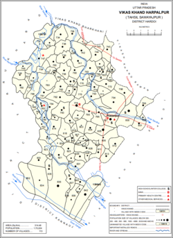
Harpalpur
Harpālpur | |
|---|---|
Populated place | |
 Map showing Harpalpur (#797) in Harpalpur CD block | |
| Coordinates: 27°19′29″N 79°50′22″E / 27.324631°N 79.839526°E[1] | |
| Country | |
| State | Uttar Pradesh |
| District | Hardoi |
| Area | |
| • Total | 4.912 km2 (1.897 sq mi) |
| Population (2011)[2] | |
| • Total | 8,822 |
| • Density | 1,800/km2 (4,700/sq mi) |
| Languages | |
| • Official | Hindi |
| Time zone | UTC+5:30 (IST) |
Harpalpur is a village and corresponding community development block in Sawayajpur tehsil of Hardoi district, Uttar Pradesh, India.[2] It is located west of Sandi, on the road to Fatehgarh.[3] The main staple crops here are wheat, rice,[4] and maize.[5] Markets are held twice weekly.[4][5] As of 2011, the population of Harpalpur is 8,822, in 1,544 households.[2] The total block population is 172,224, in 29,232 households.[2]
- ^ "Geographic Names Search WebApp". Search for "Harpalpur" here.
- ^ a b c d e "Census of India 2011: Uttar Pradesh District Census Handbook - Hardoi, Part A (Village and Town Directory)" (PDF). Census 2011 India. pp. 206–30. Retrieved 29 May 2021.
- ^ Nevill, H.R. (1904). Hardoi - A Gazetteer. Allahabad: Government Press. p. 203. Retrieved 29 May 2021.
- ^ a b Census 1971 Uttar Pradesh: District Census Handbook Part X-A: Village & Town Directory, District Hardoi (PDF). 1972. pp. 128–9. Retrieved 29 May 2021.
- ^ a b Census 1981 Uttar Pradesh: District Census Handbook Part XIII-A: Village & Town Directory, District Hardoi (PDF). 1982. pp. 172–3. Retrieved 29 May 2021.

