Harpers Ferry, West Virginia | |
|---|---|
 Aerial view of Harpers Ferry from Maryland Heights at the confluence of the Shenandoah (left) and Potomac rivers | |
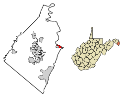
 Location of Harpers Ferry in Jefferson County, West Virginia | |
| Coordinates: 39°19′40″N 77°44′47″W / 39.32778°N 77.74639°W | |
| Country | United States |
| State | West Virginia |
| County | Jefferson |
| Area | |
| • Total | 0.62 sq mi (1.62 km2) |
| • Land | 0.54 sq mi (1.39 km2) |
| • Water | 0.09 sq mi (0.23 km2) |
| Elevation | 509 ft (155 m) |
| Population | |
| • Total | 285 |
| • Density | 527.10/sq mi (203.45/km2) |
| Time zone | UTC-5 (Eastern (EST)) |
| • Summer (DST) | UTC-4 (EDT) |
| ZIP Code | 25425 |
| Area code | 304 |
| FIPS code | 54-35284[4] |
| GNIS feature ID | 2390232[2] |
| Website | www |
Harpers Ferry is a historic town in Jefferson County, West Virginia, in the lower Shenandoah Valley. The town's population was 269 at the 2020 United States census. Situated at the confluence of the Potomac and Shenandoah rivers, where Maryland, Virginia, and West Virginia meet, it is the easternmost town in West Virginia as well as its lowest point above sea level.[5]
Originally named Harper's Ferry after an 18th-century ferry owner,[6] the town lost its apostrophe in 1891 in an update by the United States Board on Geographic Names.[7][8][9] It gained fame in 1859 when abolitionist John Brown led a raid on the Harpers Ferry Armory in a doomed effort to start a slave rebellion in Virginia and across the South.[10] During the American Civil War, the town became the northernmost point of Confederate-controlled territory, and changed hands several times due to its strategic importance.[11][12]
An antebellum manufacturing and transportation hub, Harpers Ferry has long since reoriented its economy around tourism after being largely destroyed during the Civil War.[13][14]: 10 Harpers Ferry is home to John Brown's Fort, West Virginia's most visited tourist site; the headquarters of the Appalachian Trail, whose midpoint is nearby; the former campus of Storer College, a historically black college established during Reconstruction; and one of four national training centers of the National Park Service.
Much of the lower town, which was in ruins by the end of the Civil War and ravaged by subsequent floods, has been rebuilt and preserved by the National Park Service.[14]: 15
- ^ "2019 U.S. Gazetteer Files". United States Census Bureau. Archived from the original on October 17, 2020. Retrieved August 7, 2020.
- ^ a b U.S. Geological Survey Geographic Names Information System: Harpers Ferry, West Virginia
- ^ Cite error: The named reference
wwwcensusgovwas invoked but never defined (see the help page). - ^ "U.S. Census website". United States Census Bureau. Archived from the original on December 27, 1996. Retrieved January 31, 2008.
- ^ "Did You Know???". www.wvlegislature.gov. Retrieved November 4, 2024.
- ^ Velten, John J. (1931). The history and operation of the ferry formerly at Harper's Ferry. College Park, Maryland: University of Maryland.
{{cite book}}: CS1 maint: location missing publisher (link) Thesis required for initiation into Tau Beta Pi. "The writer wishes particularly to acknowledge his indebtedness to Henry T. McDonald, President of Storer College, for his generosity in giving information on this subject". - ^ "Apostrophe Cops: Don't Be So Possessive". The New York Times Magazine. March 10, 1996. p. 21. Archived from the original on August 17, 2021. Retrieved August 17, 2021.
- ^ "Apostrophes don't always make the cut". pilotonline.com. August 27, 2013. Archived from the original on August 17, 2021. Retrieved August 17, 2021.
- ^ United States Board on Geographic Names (1892). First Report of the United States Board on Geographic Names. 1890-1891. U.S. Government Printing Office. Archived from the original on August 17, 2021. Retrieved August 17, 2021.
- ^ "Old John Brown. The Story of the Famous Raid at Harper's Ferry. A Foolhardy Attempt. It Was the Result of Thirty Years of Planning. No One Believed It Would Succeed. What Influence it Had Upon the Civil War That Soon Followed". Evening Star (Washington, D.C.). June 24, 1893. p. 7. Archived from the original on May 3, 2021. Retrieved May 3, 2021 – via newspapers.com.
- ^ Norris, J. E. (1890). History of the lower Shenandoah Valley counties of Frederick, Berkeley, Jefferson and Clarke, their early settlement and progress to the present time; geological features; a description of their historic and interesting localities; cities, towns and villages; portraits of some of the prominent men, and biographies of many of the representative citizens. Chicago: A. Warner & Co. p. 431.
- ^ Cite error: The named reference
:1was invoked but never defined (see the help page). - ^ Shackel, Paul A. (1995). "Terrible Saint: Changing Meanings of the John Brown Fort". Historical Archaeology. 29 (4): 11–25. doi:10.1007/BF03374214. JSTOR 25616421. S2CID 157100659. Archived from the original on April 19, 2021. Retrieved February 20, 2021.
- ^ a b Gilbert, David T. (1995). A Walker's Guide to Harpers Ferry West Virginia (5th ed.). Harpers Ferry Historical Association. ISBN 093312628X.


