| Harthausen Forest | |
|---|---|
 | |
| Highest point | |
| Peak | Unnamed summit |
| Elevation | 334 m above sea level (NN) |
| Geography | |
Location of the forest within the Stuttgart administrative region in Baden-Württemberg | |
| Location | Counties of Heilbronn and Hohenlohe; Baden-Württemberg, Germany |
| Range coordinates | 49°18′00″N 9°23′14″E / 49.30000°N 9.38722°E |
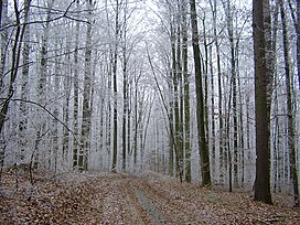
The Harthausen Forest (German: Harthäuser Wald) is a large forested area that – depending on the definition used – is 20 to over 30 km² in area. It lies in the north of Baden-Württemberg between the valleys of the lower reaches of the Jagst and Kocher on a hill ridge which is up to 334 m above sea level (NN). The largest part of the forest lies on the territory of Hardthausen am Kocher and thus in the county of Heilbronn district, a smaller part in the east is in Hohenlohekreis district.
The forest derives its name from the settlement Harthausen near Lampoldshausen which was abandoned in the Late Middle Ages.[1]
- ^ Topographic maps by the State Survey Office of Baden-Württemberg TK 25 and TK 50; Karte von dem Königreiche Würtemberg, Sheet 5 dated 1846
