Harvard, Massachusetts | |
|---|---|
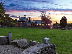
 The renovated library, established in 1856 | |
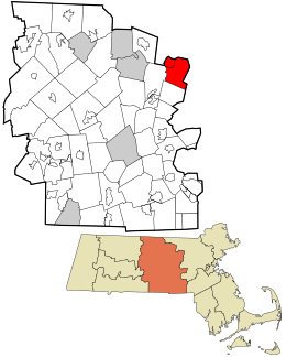
 Location in Worcester County and the state of Massachusetts. | |
| Coordinates: 42°30′00″N 71°35′00″W / 42.50000°N 71.58333°W | |
| Country | United States |
| State | Massachusetts |
| County | Worcester |
| Settled | 1658 |
| Incorporated | 1732 |
| Government | |
| • Type | Open town meeting |
| • Town Administrator | Timothy P. Bragan |
| • Select Board |
|
| Area | |
• Total | 27.0 sq mi (69.9 km2) |
| • Land | 26.4 sq mi (68.3 km2) |
| • Water | 0.6 sq mi (1.6 km2) |
| Elevation | 420 ft (128 m) |
| Population (2020) | |
• Total | 6,851 |
| • Density | 250/sq mi (98/km2) |
| Time zone | UTC-5 (Eastern) |
| • Summer (DST) | UTC-4 (Eastern) |
| ZIP code | 01451 |
| Area code | 351 / 978 |
| FIPS code | 25-28950 |
| GNIS feature ID | 0619482 |
| Website | www.harvard.ma.us |
Harvard is a town in Worcester County, Massachusetts, United States. The town is located 25 miles west-northwest of Boston, in eastern Massachusetts. It is mostly bounded by I-495 to the east and Route 2 to the north. A farming community settled in 1658 and incorporated in 1732, it has been home to several non-traditional communities, such as Harvard Shaker Village and the utopian transcendentalist center Fruitlands. It is also home to St. Benedict Abbey, a traditional Catholic monastery, and for over seventy years was home to Harvard University's Oak Ridge Observatory, at one time the most extensively equipped observatory in the Eastern United States.[1] It is now a rural and residential town noted for its public schools.[2] The population was 6,851 at the 2020 census.[3]
- ^ "Oak Ridge Station". Harvard University Collection of Historical Scientific Instruments. Archived from the original on October 3, 2023. Retrieved October 1, 2023.
- ^ "Best High Schools in the U.S." U.S. News & World Report. 2023. Archived from the original on September 27, 2023. Retrieved September 28, 2023.
- ^ "Census - Geography Profile: Harvard town, Worcester County, Massachusetts". United States Census Bureau. Archived from the original on November 11, 2021. Retrieved November 11, 2021.

