Hasbrouck Heights, New Jersey | |
|---|---|
 The Bendix Diner, a landmark on Route 17 | |
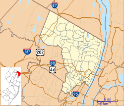
 Location of Hasbrouck Heights in Bergen County highlighted in red (left). Inset map: Location of Bergen County in New Jersey highlighted in orange (right). | |
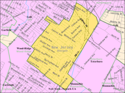
 Census Bureau map of Hasbrouck Heights, New Jersey | |
Location in Bergen County Location in New Jersey | |
| Coordinates: 40°51′46″N 74°04′31″W / 40.862751°N 74.075182°W[1][2] | |
| Country | |
| State | |
| County | Bergen |
| Incorporated | August 2, 1894 |
| Named for | J. D. Hasbrouck |
| Government | |
| • Type | Borough |
| • Body | Borough Council |
| • Mayor | Ronald F. Kistner (R, term ends December 31, 2027)[3][4] |
| • Administrator | Robert Brady[5] |
| • Municipal clerk | Michelle Sery[6] |
| Area | |
| • Total | 1.53 sq mi (3.95 km2) |
| • Land | 1.52 sq mi (3.95 km2) |
| • Water | 0.00 sq mi (0.01 km2) 0.20% |
| • Rank | 449th of 565 in state 58th of 70 in county[1] |
| Elevation | 112 ft (34 m) |
| Population | |
| • Total | 12,125 |
| • Estimate | 12,030 |
| • Rank | 209th of 565 in state 29th of 70 in county[13] |
| • Density | 7,961.3/sq mi (3,073.9/km2) |
| • Rank | 52nd of 565 in state 15th of 70 in county[13] |
| Time zone | UTC−05:00 (Eastern (EST)) |
| • Summer (DST) | UTC−04:00 (Eastern (EDT)) |
| ZIP Code | |
| Area code(s) | 201 exchanges: 288, 393, 462, 727[16] |
| FIPS code | 3400330420[1][17][18] |
| GNIS feature ID | 0885247[1][19] |
| Website | hasbrouck-heightsnj |
Hasbrouck Heights (pronounced HAZ-brook /ˈhæz.bɹʊk/[20]) is a borough in Bergen County, in the U.S. state of New Jersey. As of the 2020 United States census, the borough's population was 12,125,[10][11] an increase of 283 (+2.4%) from the 2010 census count of 11,842,[21][22] which in turn reflected an increase of 180 (+1.5%) from the 11,662 counted in the 2000 census.[23] An inner-ring suburb of New York City, Hasbrouck Heights is located approximately 10 miles (16 km) northwest of Midtown Manhattan and 8 miles (13 km) west of Upper Manhattan.
The borough was listed as the third-safest place in New Jersey[24] as well as the eighth-safest municipality in the nation according to a 2022 crime statistic compilation from Safewise.com.[25]
- ^ a b c d 2019 Census Gazetteer Files: New Jersey Places, United States Census Bureau. Accessed July 1, 2020.
- ^ U.S. Gazetteer Files, United States Census Bureau. Accessed August 31, 2017.
- ^ Cite error: The named reference
MayorCouncilwas invoked but never defined (see the help page). - ^ 2023 New Jersey Mayors Directory, New Jersey Department of Community Affairs, updated February 8, 2023. Accessed February 10, 2023.
- ^ Borough Administrator, Borough of Hasbrouck Heights. Accessed June 9, 2024.
- ^ Borough Clerk, Borough of Hasbrouck Heights. Accessed June 9, 2024.
- ^ Cite error: The named reference
DataBookwas invoked but never defined (see the help page). - ^ "ArcGIS REST Services Directory". United States Census Bureau. Retrieved October 11, 2022.
- ^ U.S. Geological Survey Geographic Names Information System: Borough of Hasbrouck Heights, Geographic Names Information System. Accessed March 5, 2013.
- ^ a b c Cite error: The named reference
Census2020was invoked but never defined (see the help page). - ^ a b Cite error: The named reference
LWD2020was invoked but never defined (see the help page). - ^ Cite error: The named reference
PopEstwas invoked but never defined (see the help page). - ^ a b Population Density by County and Municipality: New Jersey, 2020 and 2021, New Jersey Department of Labor and Workforce Development. Accessed March 1, 2023.
- ^ Look Up a ZIP Code for Hasbrouck Heights, NJ, United States Postal Service. Accessed December 14, 2011.
- ^ Zip Codes, State of New Jersey. Accessed August 16, 2013.
- ^ Area Code Lookup - NPA NXX for Hasbrouck Heights, NJ, Area-Codes.com. Accessed December 8, 2013.
- ^ U.S. Census website, United States Census Bureau. Accessed September 4, 2014.
- ^ Geographic Codes Lookup for New Jersey, Missouri Census Data Center. Accessed April 1, 2022.
- ^ US Board on Geographic Names, United States Geological Survey. Accessed September 4, 2014.
- ^ Staff. "Hasbrouck Heights", The Columbia Viking Desk Encyclopedia, p. 459. Viking Press, 1968. Accessed August 16, 2013.
- ^ Cite error: The named reference
Census2010was invoked but never defined (see the help page). - ^ Cite error: The named reference
LWD2010was invoked but never defined (see the help page). - ^ Table 7. Population for the Counties and Municipalities in New Jersey: 1990, 2000 and 2010, New Jersey Department of Labor and Workforce Development, February 2011. Accessed May 1, 2023.
- ^ Edwards, Rebecca. New Jersey’s 50 Safest Cities of 2022, SafeWise, September 29, 2022. Accessed February 3, 2023.
- ^ Edwards, Rebecca. 100 Safest Cities in the US, SafeWise, March 30, 2022. Accessed February 3, 2023.


