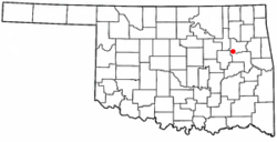
Haskell, Oklahoma | |
|---|---|
 Location of Haskell, Oklahoma | |
| Coordinates: 35°49′08″N 95°40′50″W / 35.81889°N 95.68056°W | |
| Country | United States |
| State | Oklahoma |
| County | Muskogee |
| Area | |
| • Total | 5.07 sq mi (13.13 km2) |
| • Land | 5.03 sq mi (13.03 km2) |
| • Water | 0.04 sq mi (0.11 km2) |
| Elevation | 587 ft (179 m) |
| Population (2020) | |
| • Total | 1,626 |
| • Density | 323.20/sq mi (124.79/km2) |
| Time zone | UTC-6 (Central (CST)) |
| • Summer (DST) | UTC-5 (CDT) |
| ZIP code | 74436 |
| Area code(s) | 539/918 |
| FIPS code | 40-32900[3] |
| GNIS feature ID | 2412732[2] |
| Website | Town website |
Haskell is a city, as of March 2024, in Muskogee County, Oklahoma, United States. The population was 2,007 at the 2010 census, a gain of 13.7 percent over the figure of 1,765 recorded in 2000.[4] Haskell was established in 1904 on the Midland Valley Railroad. It was named for town site developer Charles N. Haskell, who would become the first governor of the State of Oklahoma in 1907.
- ^ "ArcGIS REST Services Directory". United States Census Bureau. Retrieved September 20, 2022.
- ^ a b U.S. Geological Survey Geographic Names Information System: Haskell, Oklahoma
- ^ "U.S. Census website". United States Census Bureau. Retrieved January 31, 2008.
- ^ CensusViewer: Population of the City of Haskell, Oklahoma [1] Archived June 15, 2013, at the Wayback Machine.