| Haug Range | |
|---|---|
| Hauge Bjerge | |
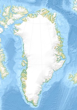
 Map of the Nares Strait area. | |
| Highest point | |
| Peak | Kayser Mountain |
| Elevation | 1,094 m (3,589 ft) |
| Dimensions | |
| Length | 60 km (37 mi) E/W |
| Width | 10 km (6.2 mi) N/S |
| Geography | |
| Country | Greenland |
| Range coordinates | 81°30′N 59°35′W / 81.500°N 59.583°W |
| Geology | |
| Rock age | Lower Silurian |
The Haug Range (Danish: Hauge Bjerge)[1] is a mountain range in far northwestern Greenland. Administratively this range is part of Avannaata municipality. The range is located in Hall Land, one of the coldest places in Greenland.[2]
This mountain chain was named after Ivar Haug, who compiled the first Gazetteer of Greenland. The area of the range is characterized by Tundra climate.[3]
- ^ "Hauge Bjerge". Mapcarta. Retrieved 15 July 2016.
- ^ "Hall Land (Grønland)". Archived from the original on 2019-01-09. Retrieved 2016-07-15.
- ^ "Peel, M C; Finlayson, B L; McMahon, T A (2007). Updated world map of the Köppen-Geiger climate classification". Hydrology and Earth System Sciences 11: sid. 1633-1644. doi:10.5194/hess-11-1633-2007. Retrieved 15 July 2016.
