 A view of a beach in Swaraj Dweep | |
| Geography | |
|---|---|
| Location | Bay of Bengal |
| Coordinates | 11°58′N 93°00′E / 11.96°N 93.00°E |
| Archipelago | Andaman Islands |
| Adjacent to | Indian Ocean |
| Total islands | 1 |
| Major islands |
|
| Area | 92.2 km2 (35.6 sq mi) |
| Length | 18 km (11.2 mi) |
| Width | 8 km (5 mi) |
| Coastline | 58.5 km (36.35 mi) |
| Highest elevation | 167 m (548 ft) |
| Highest point | Yulutang |
| Administration | |
| District | South Andaman |
| Island group | Andaman Islands |
| Island sub-group | Ritchie's Archipelago |
| Tehsil | Ritchie's Archipelago Tehsil |
| Largest settlement | Govinda Nagar |
| Demographics | |
| Population | 6,351[citation needed] (2011) |
| Pop. density | 68.5/km2 (177.4/sq mi) |
| Ethnic groups | Bengali |
| Additional information | |
| Time zone | |
| PIN | 744211[1] |
| Telephone code | 031928 [2] |
| Official website | www |
| Literacy | 84.4% |
| Avg. summer temperature | 30.2 °C (86.4 °F) |
| Avg. winter temperature | 23.0 °C (73.4 °F) |
| Sex ratio | 1.2♂/♀ |
| Census code | 35.639.0004 |
| Official languages | Hindi, English |
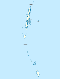
Havelock Island, officially known as Swaraj Dweep( trans Self Rule Island) ,[3] is one of the largest islands in Ritchie's Archipelago, to the east of Great Andaman within the Andaman Islands. It belongs to the South Andaman administrative district, part of the Indian union territory of Andaman and Nicobar Islands.[4] The island is 41 km (25 mi) northeast of the capital city, Port Blair.
- ^ "A&N Islands - Pincodes". 22 September 2016. Archived from the original on 23 March 2014. Retrieved 22 September 2016.
- ^ "STD Codes of Andaman and Nicobar". allcodesindia.in. Archived from the original on 17 October 2019. Retrieved 23 September 2016.
- ^ "'Bose, Shaheed and Swaraj,' PM gives new names to 3 Andaman islands". Business Standard India. Press Trust of India. 30 December 2018. Retrieved 9 July 2022.
- ^ "Village Code Directory: Andaman & Nicobar Islands" (PDF). Census of India. Retrieved 16 January 2011.
