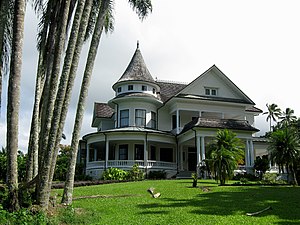
Hawaii County | |
|---|---|
 | |
 Location within the U.S. state of Hawaii | |
 Hawaii's location within the U.S. | |
| Coordinates: 19°35′N 155°30′W / 19.58°N 155.5°W | |
| Country | |
| State | |
| Founded | 1905 |
| Named for | Hawaii (Island) |
| Seat | Hilo |
| Largest community | Hilo |
| Government | |
| • Mayor | Mitch Roth |
| Area | |
• Total | 5,086.70 sq mi (13,174.5 km2) |
| • Land | 4,028.02 sq mi (10,432.5 km2) |
| • Water | 1,058.69 sq mi (2,742.0 km2) 20.81% |
| Population (2020) | |
• Total | 200,629 |
| • Density | 46/sq mi (17.7/km2) |
| Time zone | UTC−10 (Hawaii–Aleutian) |
| Congressional district | 2nd |
| Website | hawaiicounty |
Hawaii County (Hawaiian: Kalana o Hawaiʻi; officially known as the County of Hawaiʻi) is a county in the U.S. state of Hawaii in the Hawaiian Islands. It is coextensive with the Island of Hawaii, often called the "Big Island" to distinguish it from the state as a whole. The 2020 Census population was 200,629.[1] The county seat is Hilo. There are no incorporated cities in Hawaii County (see Hawaii Counties). The Hilo Micropolitan Statistical Area includes all of Hawaii County. Hawaii County has a mayor–council form of government. In terms of geography, Hawaii County is the most expansive county in the state and the most southerly county in the United States.
The mayor of Hawaii County is Mitch Roth, who took office in 2020. Legislative authority is vested in the nine-member Hawaii County Council.
Hawaii County is one of seven counties in the United States to share the same name as the state they are in (the other six are Arkansas County, Idaho County, Iowa County, New York County, Oklahoma County, and Utah County).[2]
- ^ "HAWAII: 2020 Census". United States Census Bureau. Retrieved April 4, 2022.
- ^ Joseph Nathan Kane; Charles Curry Aiken (2005). The American Counties: Origins of County Names, Dates of Creation, and Population Data, 1950-2000. Scarecrow Press. ISBN 978-0-8108-5036-1.
