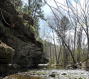
| Hawn State Park | |
|---|---|
 | |
| Location | Ste. Genevieve County, Missouri, United States |
| Coordinates | 37°49′18″N 90°14′10″W / 37.82167°N 90.23611°W[1] |
| Area | 4,955.66 acres (20.0548 km2)[2] |
| Elevation | 801 ft (244 m)[1] |
| Established | 1955[3] |
| Named for | Helen Coffer Hawn |
| Visitors | 111,110 (in 2022)[4] |
| Governing body | Missouri Department of Natural Resources |
| Website | Hawn State Park |
Hawn State Park is a public recreation area located 14 miles (23 km) southwest of Ste. Genevieve, Missouri.[5] The state park's nearly 5,000 acres (2,000 ha) include three state-designated natural areas: Pickle Creek, LaMotte Sandstone Barrens, and Botkins Pine Woods. Orchid Valley is also considered part of Hawn State Park, but is not connected to the rest of the park and is not open to the public.[6]
- ^ a b "Hawn State Park". Geographic Names Information System. United States Geological Survey, United States Department of the Interior.
- ^ Cite error: The named reference
parkdatawas invoked but never defined (see the help page). - ^ Cite error: The named reference
acquisitionwas invoked but never defined (see the help page). - ^ "Missouri State Park Attendance For January - December, 2022" (PDF). Missouri State Parks. February 3, 2023.
- ^ Cite error: The named reference
parkswas invoked but never defined (see the help page). - ^ Cite error: The named reference
parknaturewas invoked but never defined (see the help page).

