| Hayfield | |
|---|---|
 Hayfield from the north west | |
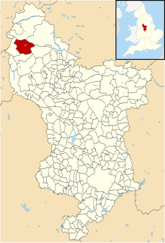
 Hayfield parish highlighted within Derbyshire | |
| Population | 2,709 (parish, 2011)[1] |
| OS grid reference | SK 03660 86902 |
| Civil parish |
|
| District | |
| Shire county | |
| Region | |
| Country | England |
| Sovereign state | United Kingdom |
| Post town | HIGH PEAK |
| Postcode district | SK22 |
| Dialling code | 01663 |
| Police | Derbyshire |
| Fire | Derbyshire |
| Ambulance | East Midlands |
| UK Parliament | |
Hayfield (SK037870) is a village and civil parish in High Peak, Derbyshire, England, with a population of around 2,700.[1] The village is 3 miles (4.8 km) east of New Mills, 4.5 miles (7.2 km) south of Glossop and 10 miles (16 km) north of Buxton, in the basin of the River Sett.[2]
The civil parish includes Hayfield village itself, the hamlets of Little Hayfield and part of Birch Vale, and a significant proportion of the Kinder Scout plateau.
- ^ a b "Lead View Table". Neighbourhood Statistics. Retrieved 3 May 2013.
- ^ Cite error: The named reference
:0was invoked but never defined (see the help page).