| Heathcote Bendigo, Victoria | |
|---|---|
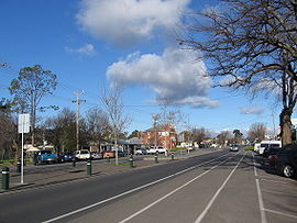
 Main street | |
 | |
| Coordinates | 36°55′S 144°42′E / 36.917°S 144.700°E |
| Population | 2,962 (2021 census)[1] |
| Postcode(s) | 3523 |
| Location | |
| LGA(s) | City of Greater Bendigo |
| State electorate(s) | Euroa |
| Federal division(s) | Bendigo |

Heathcote is a town in central Victoria, Australia, situated on the Northern Highway 110 kilometres north of Melbourne and 40 kilometres south-east of Bendigo via the McIvor Highway. Heathcote's local government area is the City of Greater Bendigo and it is part of the federal electorate of Bendigo and the state electorate of Euroa. At the 2021 census, Heathcote had a population of 2,962.[1]
- ^ a b Australian Bureau of Statistics (28 June 2022). "Heathcote (Vic.)". 2021 Census QuickStats. Retrieved 2 January 2022.
