| Henry Mountains | |
|---|---|
 Peaks in the Henry Mountains viewed from a high mountain road | |
| Highest point | |
| Peak | Mount Ellen |
| Elevation | 11,522 ft (3,512 m) |
| Coordinates | 38°6.53′N 110°48.82′W / 38.10883°N 110.81367°W |
| Geography | |
| Country | United States |
| State | Utah |
| Range coordinates | 37°56′36″N 110°41′56″W / 37.94333°N 110.69889°W[2] |
| Parent range | Rocky Mountains |
| Geology | |
| Rock type | igneous[1] |
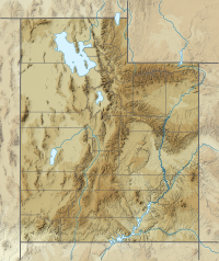
The Henry Mountains is a mountain range located in the southeastern portion of the U.S. state of Utah that runs in a generally north-south direction, extending over a distance of about 30 miles (48 km). They were named by Almon Thompson in honor of Joseph Henry, the first secretary of the Smithsonian Institution. The nearest town of any size is Hanksville, Utah, which is north of the mountains. The Henry Mountains were the last mountain range to be added to the map of the 48 contiguous U.S. states (1872),[3] and before their official naming by Thompson were sometimes referred to as the "Unknown Mountains." In Navajo, the range is still referred to as Dził Bizhiʼ Ádiní ("mountain whose name is missing").[4]
Most lands within the Henry Mountains are federally owned, public lands administered by the U.S. Bureau of Land Management. A herd of 350 American Bison roams freely in the Henrys.
- ^ Cite error: The named reference
Gilbert1880was invoked but never defined (see the help page). - ^ "Henry Mountains". Geographic Names Information System. United States Geological Survey, United States Department of the Interior. Retrieved 2021-01-29.
- ^ Heath, Steven H. (1997). "A Historical Sketch of the Scientific Exploration of the Region Containing the Grand Staircase-Escalante National Monument". Bureau of Land Management Science Symposium. Archived from the original on 2012-10-06. Retrieved 2009-07-05.
- ^ Linford, L. Navajo Places. History, Legend, Landscape. University of Utah Press. 2000.
