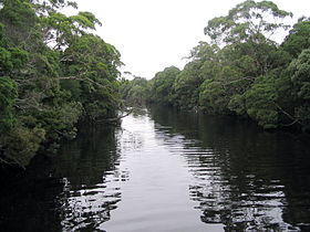
| Henty River | |
|---|---|
 Henty River, Tasmania | |
| Location | |
| Country | Australia |
| State | Tasmania |
| Region | West Coast |
| Physical characteristics | |
| Source | Tyndall Range, West Coast Range |
| Source confluence | Dobson Creek and Newton Creek |
| • location | below Mount Tyndall |
| • coordinates | 41°53′19″S 145°32′43″E / 41.88861°S 145.54528°E |
| • elevation | 264 m (866 ft) |
| Mouth | Southern Ocean |
• location | Henty Dunes |
• coordinates | 42°2′44″S 145°14′43″E / 42.04556°S 145.24528°E |
• elevation | 0 m (0 ft) |
| Length | 46 km (29 mi) |
| Basin size | 1009834 sm |
| Basin features | |
| Tributaries | |
| • left | Yolande River, Lost Creek (Tasmania), Tully River (Tasmania) |
| • right | Ewart Creek, Malcom Creek, Bottle Creek, McCutcheons Creek, Badger River |
| [1] | |
The Henty River is a perennial river in the West Coast region of Tasmania, Australia. The river generally lies north of Queenstown and south of Zeehan.
- ^ "Map of Henty River, TAS". Bonzle Digital Atlas of Australia. Retrieved 26 June 2015.
