This article contains wording that promotes the subject in a subjective manner without imparting real information. (June 2015) |
You can help expand this article with text translated from the corresponding article in Spanish. (July 2010) Click [show] for important translation instructions.
|
Herrera | |
|---|---|
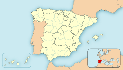
 Map of Spain with Hererra highlighted | |
| Country | Spain |
| A. community | Andalusia |
| Province | Seville |
| Municipality | Herrera |
| Government | |
| • Alcalde | Jorge Muriel Jiménez (PP) |
| Area | |
| • Total | 5,348 km2 (2,065 sq mi) |
| Elevation | 254 m (833 ft) |
| Population (2018)[1] | |
| • Total | 6,485 |
| • Density | 122.03/km2 (316.1/sq mi) |
| Demonym(s) | Herrereños, herrereñas |
| Time zone | UTC+1 (CET) |
| • Summer (DST) | UTC+2 (CEST) |
| Website | www.herrera.es/ |
Preview warning: Page using Template:Infobox settlement with unknown parameter "longitude"
Preview warning: Page using Template:Infobox settlement with unknown parameter "latitude"

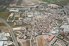
Herrera is a Spanish municipality located in the province of Seville, Andalusia. It has a population of 6,484 (as of 2018) and an area of 53,48 km², and is 120 km from the provincial capital, Seville. It is located at a crossroad in the geographical center of Andalusia, less than an hour from provincial capitals such as Córdoba, Málaga and Seville, and just over an hour from Granada. Its name is derived from the Latin inscriptions on the shield displayed on its flag: Populus (village), Natus (born), Ignique (fire), and Ferro (iron).
- ^ Municipal Register of Spain 2018. National Statistics Institute.

