Hibiscus Coast | |
|---|---|
Suburban area | |
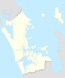
Location in the Auckland Region | |
| Coordinates: 36°36′21″S 174°41′52″E / 36.6058°S 174.6978°E | |
| Country | New Zealand |
| Island | North Island |
| Region | Auckland |
| Electoral ward | Albany Ward |
| Local board | Hibiscus and Bays |
| Electorate | Whangaparāoa Te Tai Tokerau |
| Area | |
| • Total | 49.38 km2 (19.07 sq mi) |
| Population | |
| • Estimate (June 2023)[2] | 64,660 |
| Time zone | UTC+12 (NZST) |
| • Summer (DST) | UTC+13 (NZDT) |
The Hibiscus Coast is a populated area on a stretch of the Hauraki Gulf coast in New Zealand's Auckland Region. It has a population of 64,660 (June 2023),[2] making it the 10th most populous urban area in New Zealand, and the second most populous in the Auckland Region, behind Auckland itself. As an urban area delineated by Statistics New Zealand, the Hibiscus Coast consists of Hatfields Beach, Orewa, Silverdale and Whangaparāoa Peninsula. The Auckland Council's Hibiscus Coast subdivision of the Hibiscus and Bays includes the neighbouring communities of Waiwera and Stillwater,[3] and Milldale in Rodney, is also described as a part of the Hibiscus Coast.[4]
Tāmaki Māori settled the Hibiscus Coast area since at least the 13th century, utilising the resources of the Weiti River, Ōrewa River and Whangaparāoa Bay, where an important shark fishery was located. After the Kawerau warrior Maki unified many of the Tāmaki Māori people of the northern and western Auckland Region, his children and grandchildren established hapū including Ngāti Kahu, Ngāti Maraeariki and Ngāti Manuhiri. Ngāti Kahu and Ngāti Pāoa from the Hauraki Gulf fought for control over the Whangaparāoa Bay shark fishery in the 18th century. After fleeing the area in the 1820s due to the Musket Wars, Ngāti Kahu returned to the Hibiscus Coast, living here until the 1870s.
The Hibiscus Coast was a part of the Mahurangi Block, forest sold to the Crown in 1841. Kauri loggers and itinerant kauri gum diggers were among the first Europeans to come to the area. The township of Silverdale, then known as The Wade, was established as a logging town along the Weiti River, and the Waiwera Hot Pools became a popular tourist attraction in the latter 19th century.
Orewa and the Whangaparāoa Peninsula became popular tourist destinations in the 1920s, when holiday baches were constructed in the area. During World War II, a New Zealand Army base was constructed at the end of the peninsula. The area rapidly developed in the 1950s and 1960s, in part due to the opening of the Auckland Harbour Bridge, and town centres were constructed in Orewa and Whangaparāoa. The 1960s saw the opening of two regional parks, Wenderholm Regional Park, adjacent to the Hibiscus Cost, and Shakespear Regional Park, at the eastern headland of the Whangaparāoa Peninsula.
The Hibiscus Coast was connected to the Auckland Northern Motorway in the late 1990s, after which further residential development occurred on the coast, most notably at Silverdale. In 2023, construction began on O Mahurangi Penlink, a new motorway to Whangaparāoa, crossing the Weiti River.
- ^ Cite error: The named reference
:0was invoked but never defined (see the help page). - ^ a b "Subnational population estimates (RC, SA2), by age and sex, at 30 June 1996-2023 (2023 boundaries)". Statistics New Zealand. Retrieved 25 October 2023. (regional councils); "Subnational population estimates (TA, SA2), by age and sex, at 30 June 1996-2023 (2023 boundaries)". Statistics New Zealand. Retrieved 25 October 2023. (territorial authorities); "Subnational population estimates (urban rural), by age and sex, at 30 June 1996-2023 (2023 boundaries)". Statistics New Zealand. Retrieved 25 October 2023. (urban areas)
- ^ "Hibiscus Coast Subdivision" (PDF). Hibiscus and Bays Greenways. Hibiscus and Bays Local Board. 2016. Retrieved 16 March 2022.
- ^ Hutt, Kendall (15 March 2021). "Two new primary schools on the way for north Auckland's Hibiscus Coast". Stuff. Retrieved 12 January 2024.


