Hikurangi | |
|---|---|
Town | |
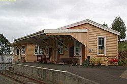
 Hikurangi station | |
 | |
| Coordinates: 35°35′54″S 174°17′12″E / 35.59833°S 174.28667°E | |
| Country | New Zealand |
| Region | Northland Region |
| District | Whangarei District |
| Ward | Hikurangi-Coastal Ward |
| Electorates | |
| Government | |
| • Territorial Authority | Whangarei District Council |
| • Regional council | Northland Regional Council |
| • Mayor of Whangārei | Vince Cocurullo |
| • Whangārei MP | Shane Reti |
| • Te Tai Tokerau MP | Mariameno Kapa-Kingi |
| Area | |
• Total | 4.00 km2 (1.54 sq mi) |
| Population (June 2024)[2] | |
• Total | 1,800 |
| • Density | 450/km2 (1,200/sq mi) |

Hikurangi is a settlement in Northland, New Zealand. The city of Whangārei is 17 kilometres (11 mi) to the south, and Kawakawa is 39 kilometres (24 mi) northwest. The Glenbervie Forest is southeast of the settlement. State Highway 1 once passed through the town, but now bypasses it to the west.[3][4] Mount Hikurangi is a volcanic dome rising 365 metres (1,198 ft) to the west of the town. It is 1.2 million years old, and part of the Harbour Fault which also includes Parakiore, near Kamo, and Parihaka in Whangarei.[5]
Hikurangi is a service town for the local dairy industry.[6]
- ^ Cite error: The named reference
Areawas invoked but never defined (see the help page). - ^ "Aotearoa Data Explorer". Statistics New Zealand. Retrieved 26 October 2024.
- ^ Peter Dowling, ed. (2004). Reed New Zealand Atlas. Reed Books. map 5. ISBN 0-7900-0952-8.
- ^ Roger Smith, GeographX (2005). The Geographic Atlas of New Zealand. Robbie Burton. map 24. ISBN 1-877333-20-4.
- ^ Bruce Hayward; Mike Isaac; Keith Miller; Bernhard Spörli (2002). "Introduction to Whangarei geology" (PDF). Geological Society of New Zealand. p. 27. Archived from the original (PDF) on 4 March 2009.
- ^ "Whangārei City and environs". Te Ara: The Encyclopedia of New Zealand.