| Hilldale | |
|---|---|
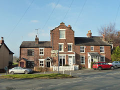
 Houses at the junction of Chorley Road and Maltkiln Lane | |
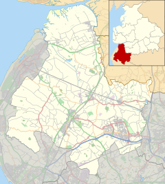
Location within Lancashire | |
| Area | 3.63 km2 (1.40 sq mi) |
| Population | 581 (2011 Census) |
| • Density | 160/km2 (410/sq mi) |
| OS grid reference | SD494121 |
| District | |
| Shire county | |
| Region | |
| Country | England |
| Sovereign state | United Kingdom |
| Post town | Skelmersdale, Wigan |
| Postcode district | WN8 |
| Post town | Ormskirk |
| Postcode district | L40 |
| Post town | Chorley |
| Postcode district | PR7 |
| Dialling code | 01257 |
| Police | Lancashire |
| Fire | Lancashire |
| Ambulance | North West |
| UK Parliament | |
Hilldale is a civil parish in the West Lancashire district of Lancashire, England, containing the village of Hill Dale and the neighbouring hamlet of Andertons Mill. Formerly part of Wrightington, Hilldale became a separate civil parish in 1999. As of 2011, Hilldale has a population of 581.

