Hillmorton | |
|---|---|
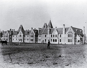
 Sunnyside Hospital, once the best-known institution of Hillmorton | |
 | |
| Coordinates: 43°33′19″S 172°35′31″E / 43.555231°S 172.591994°E | |
| Country | New Zealand |
| City | Christchurch |
| Local authority | Christchurch City Council |
| Electoral ward |
|
| Community board |
|
| Area | |
| • Land | 292 ha (722 acres) |
| Population (June 2024)[3] | |
• Total | 3,030 |
| Hospitals | Hillmorton Hospital |
| Middleton | Addington | |
| Wigram |
|
Spreydon |
| Aidanfield | Hoon Hay |
Hillmorton is a suburb of south-western Christchurch, New Zealand. The suburb is centred around the intersection of Lincoln Road and Hoon hay Road, two arterial routes which form part of State Highway 75 and feed into the Christchurch Southern Motorway which runs to the north of the suburb.
- ^ "Wards, Councillors and Community Boards map". ccc.govt.nz. Christchurch City Council. Retrieved 14 August 2020.
- ^ Cite error: The named reference
Areawas invoked but never defined (see the help page). - ^ "Aotearoa Data Explorer". Statistics New Zealand. Retrieved 26 October 2024.