Hillsdale | |
|---|---|
Neighborhood | |
 | |
 Location in Portland | |
| Coordinates: 45°28′43″N 122°41′43″W / 45.478722°N 122.695294°W | |
| Country | United States |
| State | Oregon |
| City | Portland |
| Government | |
| • Association | Hillsdale Neighborhood Association |
| • Coalition | Southwest Neighborhoods, Inc. |
| Area | |
• Total | 2.01 sq mi (5.20 km2) |
| Population (2000)[1] | |
• Total | 7,436 |
| • Density | 3,700/sq mi (1,400/km2) |
| Housing | |
| • No. of households | 3397 |
| • Occupancy rate | 97% occupied |
| • Owner-occupied | 2216 households (65%) |
| • Renting | 1181 households (35%) |
| • Avg. household size | 2.19 persons |
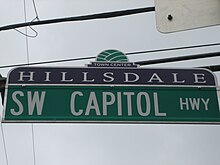
The Hillsdale district is a neighborhood in the southwest section of Portland, Oregon, United States. It is centered on the Hillsdale retail and business area, a series of strip malls on SW Capitol Highway between SW Sunset Boulevard and SW Bertha Boulevard. It is home to the Hillsdale Farmer's Market, which takes place on Sundays during the summer and every other Sunday during the winter. Hillsdale is also home to Oregon's first brewpub, with the opening of McMenamins Hillsdale Brewery in 1985.[2]
A cornerstone of the neighborhood is the Hillsdale Library, which opened in 1957. The building closed in 2001 for remodeling, and reopened March 4, 2004. When completed, the library was named a Certified Gold Leadership in Energy and Environmental Design Building. It was the first LEED building in Portland. As of 2019, the Hillsdale Library is the fifth-busiest branch in Multnomah County.[3]
Hillsdale borders Southwest Hills, Healy Heights, and Homestead on the north, South Portland on the east, South Burlingame and Multnomah on the south, and Hayhurst and Bridlemile on the west.
Oregon Route 10 connects Hillsdale to Downtown Portland to the north and to Raleigh Hills and Beaverton to the west.
Hillsdale is the center of Portland's Jewish community.[4][5]
- ^ a b Demographics (2000)
- ^ "Portland breweries". Travel Portland. 2013-06-20. Retrieved 2019-02-18.
- ^ Gallagher, Bill. "How the Hillsdale Library led the way in better building practices". Retrieved 2019-02-28.
- ^ Buchanan, Corey. "Hillsdale remains Jewish center despite changes". Retrieved 2019-12-11.
- ^ Oregonian/OregonLive, Melissa Binder | The (2015-10-21). "Orthodox Jews streaming into Portland, thanks to new infrastructure". oregonlive. Retrieved 2019-12-11.
