| Hisar Range | |
|---|---|
 View of the Anzob Pass across the Hisar Range with the Zarafshan Range in the background | |
| Highest point | |
| Peak | Alpomish Peak |
| Elevation | 4,668 m (15,315 ft) |
| Coordinates | 38°55′N 68°15′E / 38.917°N 68.250°E |
| Naming | |
| Native name | |
| Geography | |
| Countries | Tajikistan, Uzbekistan |
| Parent range | Pamir Mountains |
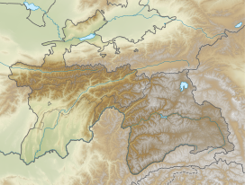
The Hisar Range,[a] formerly the Gissar Range,[b] is a mountain range in Central Asia, in the western part of the Pamir-Alay system, stretching over 200 km in the general east–west direction across the territory of Tajikistan and Uzbekistan.
Cite error: There are <ref group=lower-alpha> tags or {{efn}} templates on this page, but the references will not show without a {{reflist|group=lower-alpha}} template or {{notelist}} template (see the help page).
