Hoboken | |
|---|---|
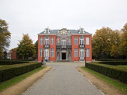
 Sorghvliedt Castle or Kasteel Sorghvliedt | |
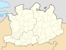
 Location of Hoboken in Antwerp | |
| Coordinates: 51°10′00″N 4°22′00″E / 51.16667°N 4.36667°E | |
| Country | |
| Community | |
| Region | |
| Province | |
| Arrondissement | Antwerp |
| Municipality | Antwerp |
| Area | |
• Total | 10.51 km2 (4.06 sq mi) |
| Highest elevation | 6 m (20 ft) |
| Lowest elevation | 0 m (0 ft) |
| Population (2021-01-01)[1] | |
• Total | 41,220 |
| • Density | 3,900/km2 (10,000/sq mi) |
| Postal codes | 2660 |
| Area codes | 03 |
| Website | [1] |
Hoboken (Dutch pronunciation: [ˈɦoːboːkə(n)]) is a southern district of the arrondissement and city of Antwerp, in the Flemish Region of Belgium. It is located at the Scheldt river. The name of the district has its origins in Middle Dutch.
- ^ a b "Bevolking per statistische sector – Sector 11002V". Statistics Belgium. Retrieved 9 May 2022.


