| Hochspeyerbach | |
|---|---|
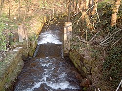
 Hochspeyerbach at Weidenthal | |
| Location | |
| Country | Germany |
| Region | Palatinate forest |
| Physical characteristics | |
| Source | |
| • location | in Hochspeyer |
| • coordinates | 49°26′27″N 7°53′34″E / 49.44083°N 7.89278°E |
| • elevation | 267 m (876 ft) |
| Mouth | |
• location | Confluence with Speyerbach at Frankeneck |
• coordinates | 49°22′34″N 8°3′12″E / 49.37611°N 8.05333°E |
• elevation | 170 m (560 ft) |
| Length | 21.33 km (13.25 mi) |
| Basin size | 119 km2 (46 sq mi) |
| Discharge | |
| • average | 0.841 m3/s (29.7 cu ft/s) |
| Basin features | |
| Progression | Speyerbach→ Rhine→ North Sea |
| Tributaries | |
| • left | Fischbach, Glasbach, Erlenbach |
| • right | Leinbach |
The Hochspeyerbach is a 21 km (13 mi) long river in the Palatinate forest in Rhineland-Palatinate and a left tributary of the Speyerbach.