This article needs additional citations for verification. (August 2022) |
Hof van Twente | |
|---|---|
 Farmhouse in Deldeneresch | |
 Location in Overijssel | |
| Coordinates: 52°14′N 6°35′E / 52.233°N 6.583°E | |
| Country | Netherlands |
| Province | Overijssel |
| Established | 1 January 2001[1] |
| Seat | Goor |
| Government | |
| • Body | Municipal council |
| • Mayor | Ellen Nauta (CDA) |
| Area | |
• Total | 215.41 km2 (83.17 sq mi) |
| • Land | 212.56 km2 (82.07 sq mi) |
| • Water | 2.85 km2 (1.10 sq mi) |
| Elevation | 12 m (39 ft) |
| Population (January 2021)[5] | |
• Total | 35,040 |
| • Density | 165/km2 (430/sq mi) |
| Time zone | UTC+1 (CET) |
| • Summer (DST) | UTC+2 (CEST) |
| Postcode | 7470–7479, 7490–7499 |
| Area code | 0547, 074 |
| Website | www |

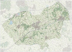
Hof van Twente (Dutch pronunciation: [ˈɦɔfɑn ˈtʋɛntə] ) is a municipality in the region Twente, in the province Overijssel in the eastern Netherlands. The municipality was established January 1, 2001, as the result of the merger of the municipalities of Diepenheim, Goor, Markelo, Ambt Delden, and Stad Delden.
- ^ "Gemeentelijke indeling op 1 januari 2001" [Municipal divisions on 1 January 2001]. cbs.nl (in Dutch). CBS. Retrieved 30 March 2014.
- ^ "Burgemeester Ellen Nauta" [Mayor Ellen Nauta] (in Dutch). Gemeente Hof van Twente. Archived from the original on 28 July 2014. Retrieved 30 March 2014.
- ^ "Kerncijfers wijken en buurten 2020" [Key figures for neighbourhoods 2020]. StatLine (in Dutch). CBS. 24 July 2020. Retrieved 19 September 2020.
- ^ "Postcodetool for 7471DK". Actueel Hoogtebestand Nederland (in Dutch). Het Waterschapshuis. Archived from the original on 21 September 2013. Retrieved 30 March 2014.
- ^ "Bevolkingsontwikkeling; regio per maand" [Population growth; regions per month]. CBS Statline (in Dutch). CBS. 1 January 2021. Retrieved 2 January 2022.
