Hole in the Rock Trail | |
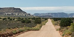
 The Hole in the Rock Trail passes between the Kaiparowits Plateau and the Escalante River | |
| Location | Garfield / Kane / San Juan counties, Utah, USA |
|---|---|
| Nearest city | Escalante, Utah |
| Coordinates | 37°43′39″N 111°31′53″W / 37.72750°N 111.53139°W |
| Built | 1879 |
| NRHP reference No. | 82004792 |
| Added to NRHP | August 09, 1982[1] |
The Hole in the Rock Trail (often hyphenated as Hole-in-the-Rock) is a historic trail running east-southeast from the town of Escalante in southern Utah in the western United States. The Mormon colonizers who established this trail crossed the Colorado River and ended their journey in the town of Bluff. The Hole-in-the-Rock expedition established the trail in 1879. The trail is located within the borders of the Grand Staircase–Escalante National Monument, the adjacent Glen Canyon National Recreation Area and federal Bureau of Land Management (BLM) public land to the east of the Colorado River. A geologic feature called the Hole in the Rock gave the trail its name. A modern unpaved road called the Hole-in-the-Rock Road (BLM Road 200) closely follows this historic trail to the point where it enters the Glen Canyon National Recreation Area. The modern road is an important access route for visiting the Canyons of the Escalante and the Devils Garden. The trail is listed on the National Register of Historic Places, being added to that list in 1982.[1]
- ^ a b "National Register Information System". National Register of Historic Places. National Park Service. March 13, 2009.

