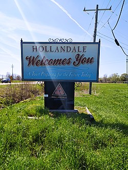
Hollandale, Mississippi | |
|---|---|
 | |
 Location of Hollandale, Mississippi | |
| Coordinates: 33°10′24″N 90°51′19″W / 33.17333°N 90.85528°W | |
| Country | United States |
| State | Mississippi |
| County | Washington |
| Area | |
• Total | 2.22 sq mi (5.74 km2) |
| • Land | 2.22 sq mi (5.74 km2) |
| • Water | 0.00 sq mi (0.00 km2) |
| Elevation | 115 ft (35 m) |
| Population (2020) | |
• Total | 2,323 |
| • Density | 1,048.29/sq mi (404.83/km2) |
| Time zone | UTC-6 (Central (CST)) |
| • Summer (DST) | UTC-5 (CDT) |
| ZIP code | 38748 |
| Area code | 662 |
| FIPS code | 28-32900 |
| GNIS feature ID | 0671293 |
Hollandale is a city in Washington County, Mississippi, United States. The population was 2,323 at the 2020 census.[2]
Deer Creek flows through Hollandale, and the Leroy Percy State Park is west of the city along Mississippi Highway 12. The Hollandale Municipal Airport is northeast of the city.
A 2008 study by the University of North Carolina described Hollandale as "a small community that has been mired in poverty for decades."[3]
- ^ "2020 U.S. Gazetteer Files". United States Census Bureau. Retrieved July 24, 2022.
- ^ "United States Census Bureau". Retrieved July 18, 2022.
- ^ Lambe, Will (December 2008). "Small Towns, Big Ideas" (PDF). School of Government, University of North Carolina at Chapel Hill. Archived from the original (PDF) on January 14, 2014. Retrieved September 6, 2013.
