Hollins, Virginia | |
|---|---|
| Coordinates: 37°20′23″N 79°57′11″W / 37.33972°N 79.95306°W | |
| Country | United States |
| State | Virginia |
| Counties | Roanoke, Botetourt |
| Area | |
• Total | 8.7 sq mi (22.5 km2) |
| • Land | 8.7 sq mi (22.5 km2) |
| • Water | 0.0 sq mi (0.0 km2) |
| Elevation | 1,112 ft (339 m) |
| Population (2020) | |
• Total | 15,574 |
| • Density | 1,800/sq mi (690/km2) |
| Time zone | UTC−5 (Eastern (EST)) |
| • Summer (DST) | UTC−4 (EDT) |
| ZIP code | 24019 |
| Area code | 540 |
| FIPS code | 51-37880 |
| GNIS feature ID | 1499567 |
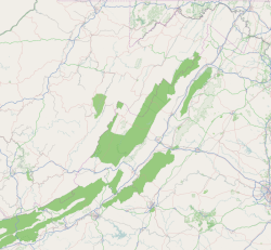
Hollins is a census-designated place (CDP) in Botetourt and Roanoke County, Virginia, United States. Hollins covers much of the area known locally as "North County". The population was 15,574 at the 2020 census.[1] It is part of the Roanoke Metropolitan Statistical Area. The area is also the home of Hollins University in addition to four properties listed on the National Register of Historic Places: the Black Horse Tavern-Bellvue Hotel and Office, Harshbarger House, the Hollins College Quadrangle, and Old Tombstone.
- ^ "U.S. Census Bureau QuickFacts: Hollins CDP, Virginia". Census.gov. Retrieved July 20, 2022.


