Holly, Colorado | |
|---|---|
 Former Holly Santa Fe Depot, currently is town hall (2010) | |
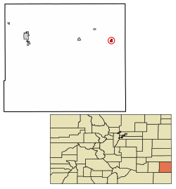
 Location with Prowers County and Colorado | |
| Coordinates: 38°03′18″N 102°07′34″W / 38.05500°N 102.12611°W[2] | |
| Country | United States |
| State | Colorado |
| County | Prowers |
| Incorporated | September 4, 1903[3] |
| Area | |
• Total | 0.7244 sq mi (1.8763 km2) |
| • Land | 0.7234 sq mi (1.8737 km2) |
| • Water | 0.0010 sq mi (0.0026 km2) |
| Elevation | 3,396 ft (1,035 m) |
| Population | |
• Total | 837 |
| • Density | 1,200/sq mi (450/km2) |
| Time zone | UTC−7 (MST) |
| • Summer (DST) | UTC−6 (MDT) |
| ZIP Code[5] | 81047 |
| Area code | 719 |
| FIPS code | 08-37215 [2] |
| GNIS ID | 2412764 [2] |
| Website | townofholly.com |
Holly is a statutory town in Prowers County in southeastern Colorado, United States.[2] The town is located 4.3 miles (6.9 km) west of the Kansas border at an elevation of 3,393 feet (1,034 m). Despite having the lowest elevation of any Colorado municipality, Holly is higher than the high points of 19 states and the District of Columbia. The town population was 837 at the 2020 United States Census.[4]
- ^ "Active Colorado Municipalities". Colorado Department of Local Affairs. Retrieved December 24, 2021.
- ^ a b c d e "Holly, Colorado", Geographic Names Information System, United States Geological Survey, United States Department of the Interior
- ^ "Colorado Municipal Incorporations". State of Colorado, Department of Personnel & Administration, Colorado State Archives. December 1, 2004. Retrieved September 2, 2007.
- ^ a b c "QuickFacts for Colorado". United States Census Bureau. Retrieved December 24, 2021.
- ^ "ZIP Code Lookup". United States Postal Service. Archived from the original (JavaScript/HTML) on November 4, 2010. Retrieved October 5, 2007.