| Holston River | |
|---|---|
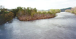
 The North Fork of the Holston River near Weber City, Virginia. | |
 | |
| Location | |
| Country | United States |
| State | Virginia, Tennessee |
| Physical characteristics | |
| Source | North Fork Holston River |
| • location | Bland County, Virginia |
| • coordinates | 37°03′51″N 81°16′15″W / 37.06417°N 81.27083°W[1] |
| • elevation | 2,880 ft (880 m) |
| 2nd source | South Fork Holston River |
| • location | Smyth County, Virginia |
| • coordinates | 36°46′11″N 81°22′04″W / 36.76972°N 81.36778°W[2] |
| • elevation | 2,900 ft (880 m) |
| 3rd source | |
| • location | Kingsport, Tennessee |
| • coordinates | 36°32′51″N 82°36′44″W / 36.54750°N 82.61222°W[3] |
| • elevation | 1,158 ft (353 m) |
| Mouth | Tennessee River |
• location | Knoxville, Tennessee |
• coordinates | 35°57′33″N 83°51′0″W / 35.95917°N 83.85000°W[3] |
• elevation | 814 ft (248 m)[3] |
| Length | 136 mi (219 km)[3] |
| Basin size | 3,776 sq mi (9,780 km2)[4] |
| Discharge | |
| • location | J. Will Taylor Bridge (Hwy. 70) near Knoxville, Tennessee, 5.5 miles (8.9 km) above the mouth(mean for water years 1931–1975, 1979-1983)[5] |
| • average | 4,759 cu ft/s (134.8 m3/s)(mean for water years 1931–1975, 1979-1983)[5] |
| • minimum | 44 cu ft/s (1.2 m3/s)December 1941[5] |
| • maximum | 62,900 cu ft/s (1,780 m3/s)March 1935[5] |
| Basin features | |
| River system | Tennessee → Ohio → Mississippi |
The Holston River is a 136-mile (219 km) river that flows from Kingsport, Tennessee, to Knoxville, Tennessee. Along with its three major forks (North Fork, Middle Fork and South Fork), it comprises a major river system that drains much of northeastern Tennessee, southwestern Virginia, and northwestern North Carolina. The Holston's confluence with the French Broad River at Knoxville marks the beginning of the Tennessee River.
- ^ U.S. Geological Survey Geographic Names Information System: North Fork Holston River
- ^ U.S. Geological Survey Geographic Names Information System: South Fork Holston River
- ^ a b c d U.S. Geological Survey Geographic Names Information System: Holston River
- ^ U.S. Geological Survey, "Introduction to the Upper Tennessee River Basin," 11 January 2013. Accessed: 2 June 2015.
- ^ a b c d United States Geological Survey, Water Resources Data Tennessee: Water Year 1983, Water Data Report TN-83-1, p. 123.