Holy Cross | |
|---|---|
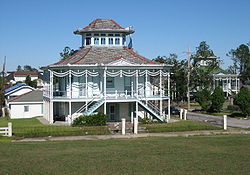
 The Doullut "Steamboat houses" from the start of the 20th century | |
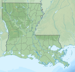
| Coordinates: 29°57′30″N 90°01′04″W / 29.95833°N 90.01778°W | |
| Country | United States |
| State | Louisiana |
| City | New Orleans |
| Planning District | District 7, Bywater District |
| Area | |
| • Total | 0.95 sq mi (2.5 km2) |
| • Land | 0.68 sq mi (1.8 km2) |
| • Water | 0.27 sq mi (0.7 km2) |
| Elevation | 3 ft (0.9 m) |
| Population (2010) | |
| • Total | 1,226 |
| • Density | 1,300/sq mi (500/km2) |
| Time zone | UTC-6 (CST) |
| • Summer (DST) | UTC-5 (CDT) |
| Area code | 504 |
Holy Cross is a neighborhood of the city of New Orleans. A subdistrict of the Lower Ninth Ward District Area, its boundaries as defined by the City Planning Commission are: St. Claude Avenue to the north, St. Bernard Parish to the east, the Mississippi River to the south and the Industrial Canal to the west.
