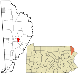
Honesdale is a borough in and the county seat of Wayne County, Pennsylvania, United States.[13] The borough's population was 4,458 at the time of the 2020 census.[14]
Honesdale is located 32 miles (51 km) northeast of Scranton in a rural area that provides many recreational opportunities, such as boating, fishing, hiking, hunting, skiing, biking, skateboarding, and rafting. Located in a coal mining region, during the nineteenth century it was the starting point of the Delaware and Hudson Canal, which provided for transport of coal to Kingston, New York, and then down the Hudson River to New York City. In the 19th century, the expansion of railroads eventually superseded regular use of the canal.
- ^ Mathews, Alfred (1886). History of Wayne, Pike, and Monroe Counties, Pennsylvania. Philadelphia: R.T. Peck & Company. p. 489. Retrieved June 2, 2015.
- ^ "The Borough". HonesdalePA.net. 2012. Archived from the original on September 20, 2013. Retrieved June 3, 2015.
- ^ a b "Welcome to Honesdale Borough". Honesdale Borough. 2012. Retrieved June 2, 2015.
- ^ "Council Members". Honesdale Borough. 2012. Retrieved June 2, 2015.
- ^ "ArcGIS REST Services Directory". United States Census Bureau. Retrieved October 12, 2022.
- ^ a b "Honesdale". Geographic Names Information System. United States Geological Survey, United States Department of the Interior. August 2, 1979. Retrieved June 2, 2015.
- ^ Cite error: The named reference
USCensusDecennial2020CenPopScriptOnlywas invoked but never defined (see the help page). - ^ "Look up a ZIP Code". USPS.COM. USPS. 2015. Retrieved June 2, 2015.
- ^ a b "Borough of Honesdale". Geographic Names Information System. United States Geological Survey. August 30, 1990. Retrieved June 2, 2015.
- ^ U.S. Census Bureau. Census 2000. "Census Demographic Profiles, Honesdale Borough" (PDF). CenStats Databases. Retrieved January 31, 2009.[dead link]
- ^ "Bunnells Pond". Geographic Names Information System. United States Geological Survey. August 2, 1979. Retrieved June 5, 2015.
- ^ "Carley Brook". Geographic Names Information System. United States Geological Survey. August 2, 1979. Retrieved June 5, 2015.
- ^ "Find a County". National Association of Counties. Archived from the original on May 31, 2011. Retrieved June 7, 2011.
- ^ "2010 Census Interactive Population Search". Census.gov. U.S. Department of Commerce. 2010. Retrieved June 2, 2015.[permanent dead link]


