Hoorn | |
|---|---|
City and municipality | |
|
| |
| Nicknames: | |
 Location within North Holland, Netherlands | |
| Coordinates: 52°39′N 5°4′E / 52.650°N 5.067°E | |
| Country | Netherlands |
| Province | North Holland |
| Subregion | West Friesland |
| City rights | 1357 (667 years ago) |
| Government | |
| • Body | Municipal council |
| • Mayor | Jan Nieuwenburg (PvdA) |
| Area | |
• Total | 53.46 km2 (20.64 sq mi) |
| • Land | 20.38 km2 (7.87 sq mi) |
| • Water | 33.08 km2 (12.77 sq mi) |
| Elevation | −1 m (−3 ft) |
| Population (1 January 2021)[3] | |
• Total | 73,619 |
| • Density | 3,613/km2 (9,360/sq mi) |
| Demonym | Hoornaar or Horinees |
| Time zone | UTC+1 (CET) |
| • Summer (DST) | UTC+2 (CEST) |
| Postal codes | 1620–1628, 1689, 1695 |
| Area code | 0229 |
| Website | www |
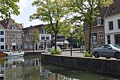
Hoorn (Dutch pronunciation: [ˈɦoːr(ə)n] ) is a city and municipality in the northwest of the Netherlands, in the province of North Holland. It is the largest town and the traditional capital of the region of West Friesland.[5] Hoorn is located on the Markermeer, 20 kilometers (12 mi) east of Alkmaar and 35 kilometers (22 mi) north of Amsterdam. The municipality has just over 73,000 inhabitants and a land area of 20.38 km2 (7.87 sq mi), making it the third most densely populated municipality in North Holland after Haarlem and Amsterdam.[3] Apart from the city of Hoorn, the municipality includes the villages of Blokker and Zwaag, as well as parts of the hamlets De Bangert, De Hulk and Munnickaij.
Hoorn is well known in the Netherlands for its rich history.[6] The town acquired city rights in 1357 and flourished during the Dutch Golden Age.[2] In this period, Hoorn developed into a prosperous port city, being home to one of the six chambers of the Dutch East India Company (VOC).[6] Towards the end of the eighteenth century, however, it started to become increasingly more difficult for Hoorn to keep competing with nearby Amsterdam.[5] Ultimately, it lost its function as port city and became a regional center of trade, mainly serving the smaller villages of West Friesland.[5] Nowadays, Hoorn is a city with modern residential areas and a historic city center that, due to its proximity to Amsterdam, is sometimes considered to be part of the Randstad metropolitan area.[7] Cape Horn and the Hoorn Islands were both named after this city.[8]
- ^ Pannekeet, Jan (1995). Westfries Woordenboek. Wormerveer: Uitgeverij Noord-Holland. p. 67. ISBN 90-71123-01-4.
- ^ a b "City of the Golden Age". Ik hou van Hoorn. Archived from the original on 26 June 2022. Retrieved 23 June 2020.
- ^ a b c "Regionale kerncijfers Nederland". CBS Statline (in Dutch). Statistics Netherlands. Retrieved 20 October 2021.
- ^ "Postcodetool for 1625HV" (in Dutch). Actueel Hoogtebestand Nederland. Archived from the original on 27 July 2014. Retrieved 10 March 2014.
- ^ a b c "Hoorn: Historie". Westfries Genootschap (in Dutch). Archived from the original on 8 December 2022. Retrieved 17 March 2019.
- ^ a b "Hoorn & Enkhuizen in the Golden Age". Holland.com. 6 October 2017. Retrieved 29 March 2020.
- ^ Nieuwe steden in de Randstad: Verstedelijking en suburbaniteit (PDF) (in Dutch). PBL. September 2012. Archived (PDF) from the original on 8 October 2020. Retrieved 12 March 2020.
- ^ "De ontdekking van Kaap Hoorn". Het Scheepvaartmuseum (in Dutch). 28 January 2016. Retrieved 23 June 2020.


