| Hopegill Head | |
|---|---|
 Hopegill Head seen from Grisedale Pike. Hobcarton Crag is beneath the fell. The grassy hill on the left is Sand Hill. | |
| Highest point | |
| Elevation | 770 m (2,530 ft) |
| Prominence | 97 m (318 ft) |
| Parent peak | Grisedale Pike |
| Listing | Wainwright, Hewitt, Nuttall |
| Coordinates | 54°35′15″N 3°15′46″W / 54.5875°N 3.26267°W |
| Naming | |
| English translation | Source of Hope Gill |
| Geography | |
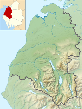
Location in the Lake District National Park | |
| Location | Cumbria, England |
| Parent range | Lake District, North Western Fells |
| OS grid | NY185221 |
| Topo map | OS Landranger 89, 90, OS Explorer Outdoor Leisure 4 |
| Name | Grid ref | Height | Status |
|---|---|---|---|
| Sand Hill | NY187218 | 756 m (2,480 ft) | Nuttall |
| Ladyside Pike | NY185227 | 703 m (2,306 ft) | Nuttall |
Hopegill Head is a fell in the English Lake District in Cumbria. It is located nine kilometres (5+1⁄2 miles) west of the town of Keswick and is well seen from the B5292 road which crosses the Whinlatter Pass.

